You are here: Home > Network List > TA - USArray Transportable Network (new EarthScope stations) Stations List
> Station O03E Paynes Creek, CA, USA > Earthquake Result Viewer
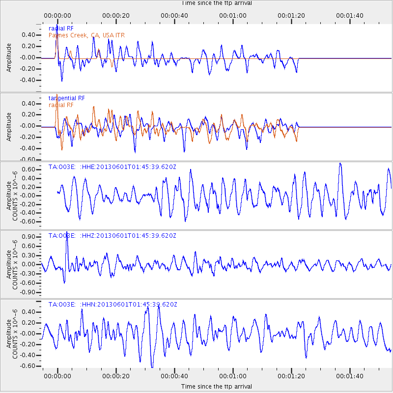
O03E Paynes Creek, CA, USA - Earthquake Result Viewer
*The percent match for this event was below the threshold and hence no stack was calculated.
| Earthquake location: |
South Of Fiji Islands |
| Earthquake latitude/longitude: |
-23.1/-177.2 |
| Earthquake time(UTC): |
2013/06/01 (152) 01:34:14 GMT |
| Earthquake Depth: |
185 km |
| Earthquake Magnitude: |
5.5 MB |
| Earthquake Catalog/Contributor: |
NEIC PDE/NEIC PDE-W |
|
| Network: |
TA USArray Transportable Network (new EarthScope stations) |
| Station: |
O03E Paynes Creek, CA, USA |
| Lat/Lon: |
40.29 N/121.80 W |
| Elevation: |
967 m |
|
| Distance: |
81.4 deg |
| Az: |
39.538 deg |
| Baz: |
230.047 deg |
| Ray Param: |
$rayparam |
*The percent match for this event was below the threshold and hence was not used in the summary stack. |
|
| Radial Match: |
50.87616 % |
| Radial Bump: |
358 |
| Transverse Match: |
54.193703 % |
| Transverse Bump: |
389 |
| SOD ConfigId: |
512894 |
| Insert Time: |
2013-09-14 21:53:54.542 +0000 |
| GWidth: |
2.5 |
| Max Bumps: |
400 |
| Tol: |
0.001 |
|
Signal To Noise
| Channel | StoN | STA | LTA |
| TA:O03E: :HHZ:20130601T01:45:39.620Z | 3.0185306 | 3.5693444E-7 | 1.18247755E-7 |
| TA:O03E: :HHN:20130601T01:45:39.620Z | 0.85797274 | 1.5131427E-7 | 1.7636256E-7 |
| TA:O03E: :HHE:20130601T01:45:39.620Z | 0.40308663 | 8.483357E-8 | 2.104599E-7 |
| Arrivals |
| Ps | |
| PpPs | |
| PsPs/PpSs | |


