You are here: Home > Network List > US - United States National Seismic Network Stations List
> Station MNTX Cornudas Mountains, Texas, USA > Earthquake Result Viewer
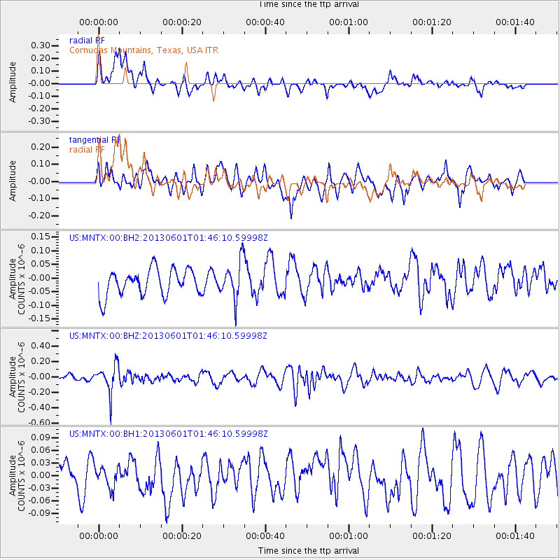
MNTX Cornudas Mountains, Texas, USA - Earthquake Result Viewer
*The percent match for this event was below the threshold and hence no stack was calculated.
| Earthquake location: |
South Of Fiji Islands |
| Earthquake latitude/longitude: |
-23.1/-177.2 |
| Earthquake time(UTC): |
2013/06/01 (152) 01:34:14 GMT |
| Earthquake Depth: |
185 km |
| Earthquake Magnitude: |
5.5 MB |
| Earthquake Catalog/Contributor: |
NEIC PDE/NEIC PDE-W |
|
| Network: |
US United States National Seismic Network |
| Station: |
MNTX Cornudas Mountains, Texas, USA |
| Lat/Lon: |
31.70 N/105.38 W |
| Elevation: |
404 m |
|
| Distance: |
87.6 deg |
| Az: |
54.141 deg |
| Baz: |
241.131 deg |
| Ray Param: |
$rayparam |
*The percent match for this event was below the threshold and hence was not used in the summary stack. |
|
| Radial Match: |
53.069214 % |
| Radial Bump: |
400 |
| Transverse Match: |
58.37669 % |
| Transverse Bump: |
400 |
| SOD ConfigId: |
512894 |
| Insert Time: |
2013-09-14 21:55:08.793 +0000 |
| GWidth: |
2.5 |
| Max Bumps: |
400 |
| Tol: |
0.001 |
|
Signal To Noise
| Channel | StoN | STA | LTA |
| US:MNTX:00:BHZ:20130601T01:46:10.59998Z | 2.8663805 | 1.8551493E-7 | 6.472097E-8 |
| US:MNTX:00:BH1:20130601T01:46:10.59998Z | 0.67842495 | 2.408648E-8 | 3.550353E-8 |
| US:MNTX:00:BH2:20130601T01:46:10.59998Z | 1.4768615 | 7.110612E-8 | 4.8146777E-8 |
| Arrivals |
| Ps | |
| PpPs | |
| PsPs/PpSs | |


