You are here: Home > Network List > PF - Volcanologic Network of Piton de Fournaise-OVPF Stations List
> Station HIM cratere Himiltrude > Earthquake Result Viewer
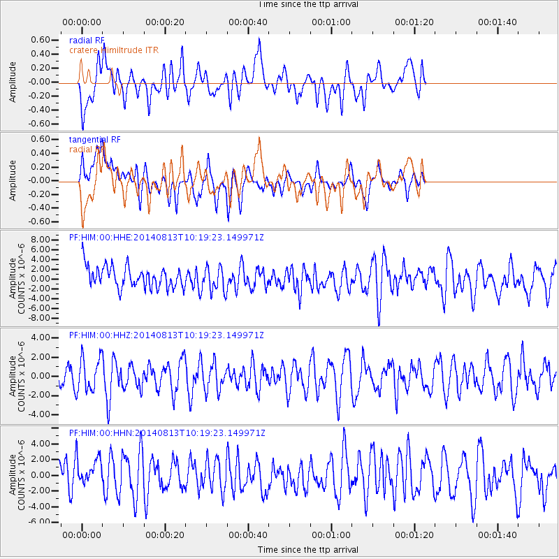
HIM cratere Himiltrude - Earthquake Result Viewer
*The percent match for this event was below the threshold and hence no stack was calculated.
| Earthquake location: |
Central Mid-Atlantic Ridge |
| Earthquake latitude/longitude: |
0.8/-26.7 |
| Earthquake time(UTC): |
2014/08/13 (225) 10:07:28 GMT |
| Earthquake Depth: |
10 km |
| Earthquake Magnitude: |
5.5 MW, 5.4 mb, 5.2 Ms_20, 5.4 Mwb, 5.5 Mwc |
| Earthquake Catalog/Contributor: |
ISC/ISC |
|
| Network: |
PF Volcanologic Network of Piton de Fournaise-OVPF |
| Station: |
HIM cratere Himiltrude |
| Lat/Lon: |
21.21 S/55.72 E |
| Elevation: |
1958 m |
|
| Distance: |
83.2 deg |
| Az: |
111.346 deg |
| Baz: |
273.526 deg |
| Ray Param: |
$rayparam |
*The percent match for this event was below the threshold and hence was not used in the summary stack. |
|
| Radial Match: |
52.968502 % |
| Radial Bump: |
400 |
| Transverse Match: |
56.100487 % |
| Transverse Bump: |
400 |
| SOD ConfigId: |
3390531 |
| Insert Time: |
2019-04-13 09:06:08.710 +0000 |
| GWidth: |
2.5 |
| Max Bumps: |
400 |
| Tol: |
0.001 |
|
Signal To Noise
| Channel | StoN | STA | LTA |
| PF:HIM:00:HHZ:20140813T10:19:23.149971Z | 1.2633497 | 1.6928152E-6 | 1.339942E-6 |
| PF:HIM:00:HHN:20140813T10:19:23.149971Z | 0.9006637 | 2.02348E-6 | 2.2466543E-6 |
| PF:HIM:00:HHE:20140813T10:19:23.149971Z | 1.1684493 | 2.5111287E-6 | 2.1491123E-6 |
| Arrivals |
| Ps | |
| PpPs | |
| PsPs/PpSs | |


