You are here: Home > Network List > TA - USArray Transportable Network (new EarthScope stations) Stations List
> Station MSTX Muleshoe, TX, USA > Earthquake Result Viewer
MSTX Muleshoe, TX, USA - Earthquake Result Viewer
*The percent match for this event was below the threshold and hence no stack was calculated.
| Earthquake location: |
Central Mid-Atlantic Ridge |
| Earthquake latitude/longitude: |
0.8/-26.7 |
| Earthquake time(UTC): |
2014/08/13 (225) 10:07:28 GMT |
| Earthquake Depth: |
10 km |
| Earthquake Magnitude: |
5.5 MW, 5.4 mb, 5.2 Ms_20, 5.4 Mwb, 5.5 Mwc |
| Earthquake Catalog/Contributor: |
ISC/ISC |
|
| Network: |
TA USArray Transportable Network (new EarthScope stations) |
| Station: |
MSTX Muleshoe, TX, USA |
| Lat/Lon: |
33.97 N/102.77 W |
| Elevation: |
1167 m |
|
| Distance: |
78.0 deg |
| Az: |
304.442 deg |
| Baz: |
97.145 deg |
| Ray Param: |
$rayparam |
*The percent match for this event was below the threshold and hence was not used in the summary stack. |
|
| Radial Match: |
69.46972 % |
| Radial Bump: |
400 |
| Transverse Match: |
64.940994 % |
| Transverse Bump: |
400 |
| SOD ConfigId: |
3390531 |
| Insert Time: |
2019-04-13 09:07:36.809 +0000 |
| GWidth: |
2.5 |
| Max Bumps: |
400 |
| Tol: |
0.001 |
|
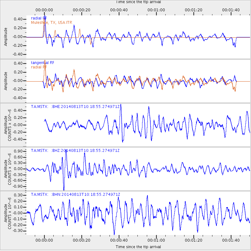
Signal To Noise
| Channel | StoN | STA | LTA |
| TA:MSTX: :BHZ:20140813T10:18:55.274971Z | 2.3567142 | 2.2964592E-7 | 9.744326E-8 |
| TA:MSTX: :BHN:20140813T10:18:55.274971Z | 0.7748021 | 7.690416E-8 | 9.925652E-8 |
| TA:MSTX: :BHE:20140813T10:18:55.274971Z | 1.8077259 | 1.4341312E-7 | 7.933345E-8 |
| Arrivals |
| Ps | |
| PpPs | |
| PsPs/PpSs | |


