CGRP Cima Grappa - Earthquake Result Viewer
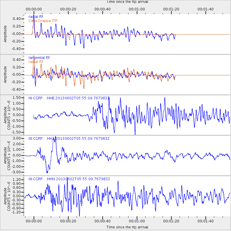
Earthquake location: Taiwan
Earthquake latitude/longitude: 23.8/121.1
Earthquake time(UTC): 2013/06/02 (153) 05:43:03 GMT
Earthquake Depth: 17 km
Earthquake Magnitude: 6.2 MW, 6.1 MB, 6.2 MS, 6.2 MW
Earthquake Catalog/Contributor: NEIC PDE/NEIC PDE-W
Network: NI North-East Italy Broadband Network
Station: CGRP Cima Grappa
Lat/Lon: 45.88 N/11.80 E
Elevation: 1757 m
Distance: 85.7 deg
Az: 318.622 deg
Baz: 60.09 deg
Ray Param: 0.044570535
Estimated Moho Depth: 27.25 km
Estimated Crust Vp/Vs: 1.98
Assumed Crust Vp: 6.155 km/s
Estimated Crust Vs: 3.116 km/s
Estimated Crust Poisson's Ratio: 0.33
Radial Match: 82.75598 %
Radial Bump: 400
Transverse Match: 67.78518 %
Transverse Bump: 400
SOD ConfigId: 512894
Insert Time: 2013-09-14 22:56:37.857 +0000
GWidth: 2.5
Max Bumps: 400
Tol: 0.001

Signal To Noise

ChannelStoNSTALTA
NI:CGRP: :HHZ:20130602T05:55:09.767983Z6.7675255.2618043E-77.775079E-8
NI:CGRP: :HHN:20130602T05:55:09.767983Z1.3451491.4784278E-71.099081E-7
NI:CGRP: :HHE:20130602T05:55:09.767983Z1.73544372.5335896E-71.4599088E-7
Arrivals
Ps4.4 SECOND
PpPs13 SECOND
PsPs/PpSs17 SECOND