You are here: Home > Network List > UW - Pacific Northwest Regional Seismic Network Stations List
> Station HOOD Mt Hood Meadows, OR CREST BB SMO > Earthquake Result Viewer
HOOD Mt Hood Meadows, OR CREST BB SMO - Earthquake Result Viewer
*The percent match for this event was below the threshold and hence no stack was calculated.
| Earthquake location: |
Central Mid-Atlantic Ridge |
| Earthquake latitude/longitude: |
0.8/-26.7 |
| Earthquake time(UTC): |
2014/08/13 (225) 10:07:28 GMT |
| Earthquake Depth: |
10 km |
| Earthquake Magnitude: |
5.5 MW, 5.4 mb, 5.2 Ms_20, 5.4 Mwb, 5.5 Mwc |
| Earthquake Catalog/Contributor: |
ISC/ISC |
|
| Network: |
UW Pacific Northwest Regional Seismic Network |
| Station: |
HOOD Mt Hood Meadows, OR CREST BB SMO |
| Lat/Lon: |
45.32 N/121.65 W |
| Elevation: |
1520 m |
|
| Distance: |
92.9 deg |
| Az: |
315.27 deg |
| Baz: |
85.889 deg |
| Ray Param: |
$rayparam |
*The percent match for this event was below the threshold and hence was not used in the summary stack. |
|
| Radial Match: |
39.35004 % |
| Radial Bump: |
400 |
| Transverse Match: |
50.77086 % |
| Transverse Bump: |
400 |
| SOD ConfigId: |
3390531 |
| Insert Time: |
2019-04-13 09:08:45.087 +0000 |
| GWidth: |
2.5 |
| Max Bumps: |
400 |
| Tol: |
0.001 |
|
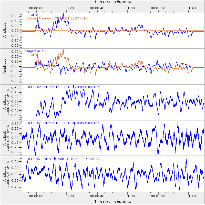
Signal To Noise
| Channel | StoN | STA | LTA |
| UW:HOOD: :BHZ:20140813T10:20:09.630012Z | 1.6321619 | 1.9154464E-7 | 1.1735641E-7 |
| UW:HOOD: :BHN:20140813T10:20:09.630012Z | 0.9636408 | 2.3333679E-7 | 2.4214086E-7 |
| UW:HOOD: :BHE:20140813T10:20:09.630012Z | 1.1147182 | 4.108815E-7 | 3.6859677E-7 |
| Arrivals |
| Ps | |
| PpPs | |
| PsPs/PpSs | |


