You are here: Home > Network List > TA - USArray Transportable Network (new EarthScope stations) Stations List
> Station J04D Umpqua National Forest, Toketee, OR, USA > Earthquake Result Viewer
J04D Umpqua National Forest, Toketee, OR, USA - Earthquake Result Viewer
*The percent match for this event was below the threshold and hence no stack was calculated.
| Earthquake location: |
Taiwan |
| Earthquake latitude/longitude: |
23.8/121.1 |
| Earthquake time(UTC): |
2013/06/02 (153) 05:43:03 GMT |
| Earthquake Depth: |
17 km |
| Earthquake Magnitude: |
6.2 MW, 6.1 MB, 6.2 MS, 6.2 MW |
| Earthquake Catalog/Contributor: |
NEIC PDE/NEIC PDE-W |
|
| Network: |
TA USArray Transportable Network (new EarthScope stations) |
| Station: |
J04D Umpqua National Forest, Toketee, OR, USA |
| Lat/Lon: |
43.24 N/122.11 W |
| Elevation: |
1948 m |
|
| Distance: |
91.6 deg |
| Az: |
40.754 deg |
| Baz: |
305.084 deg |
| Ray Param: |
$rayparam |
*The percent match for this event was below the threshold and hence was not used in the summary stack. |
|
| Radial Match: |
75.64987 % |
| Radial Bump: |
400 |
| Transverse Match: |
74.44919 % |
| Transverse Bump: |
400 |
| SOD ConfigId: |
512894 |
| Insert Time: |
2013-09-14 23:00:47.472 +0000 |
| GWidth: |
2.5 |
| Max Bumps: |
400 |
| Tol: |
0.001 |
|
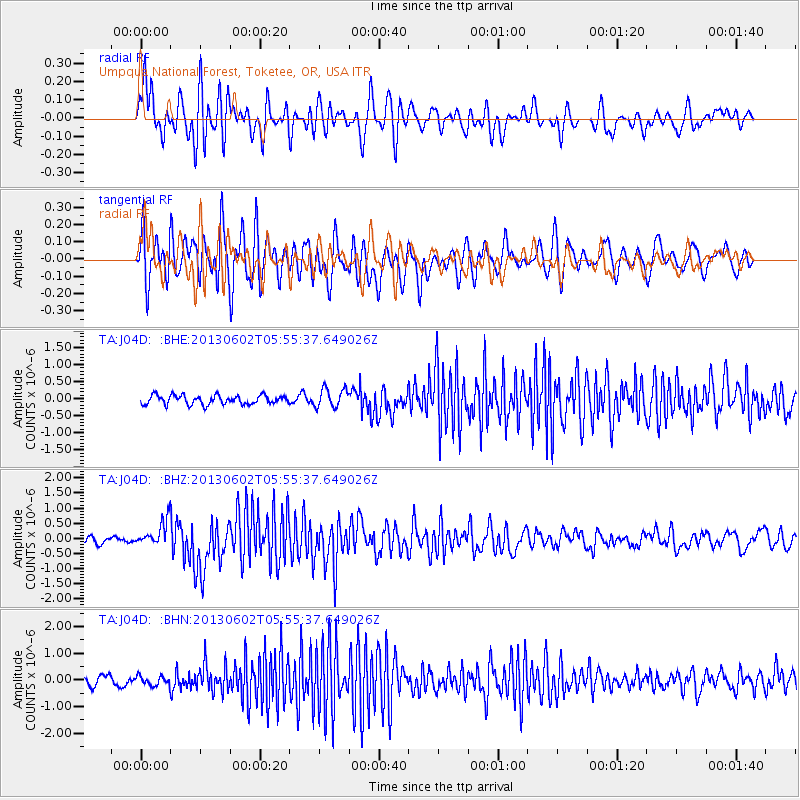
Signal To Noise
| Channel | StoN | STA | LTA |
| TA:J04D: :BHZ:20130602T05:55:37.649026Z | 3.0448613 | 4.2160605E-7 | 1.3846477E-7 |
| TA:J04D: :BHN:20130602T05:55:37.649026Z | 0.78046453 | 1.6877416E-7 | 2.1624834E-7 |
| TA:J04D: :BHE:20130602T05:55:37.649026Z | 2.076377 | 2.7560498E-7 | 1.327336E-7 |
| Arrivals |
| Ps | |
| PpPs | |
| PsPs/PpSs | |


