You are here: Home > Network List > US - United States National Seismic Network Stations List
> Station MSO Missoula, Montana, USA > Earthquake Result Viewer
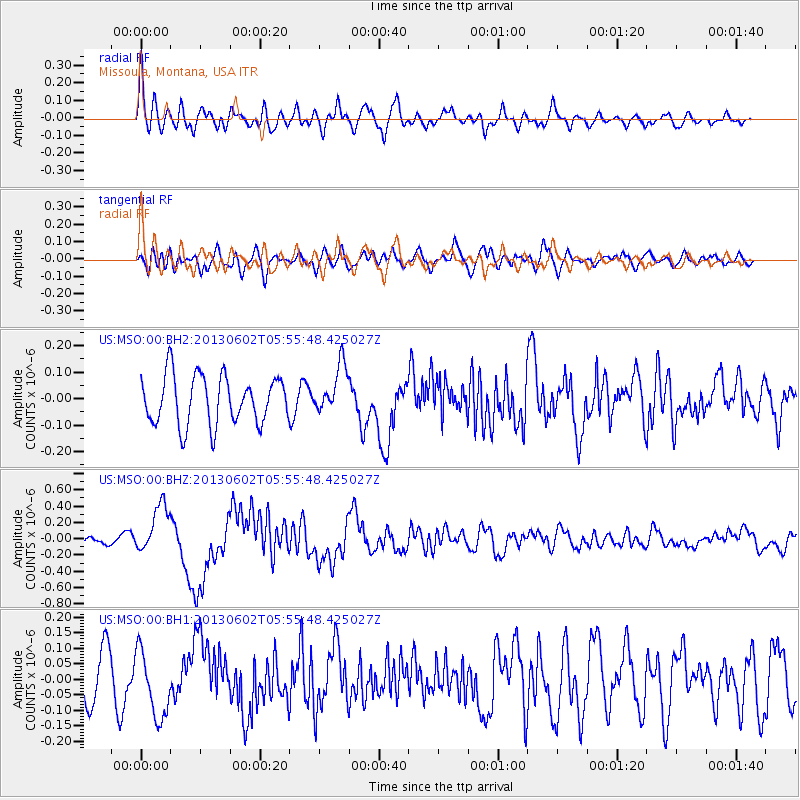
MSO Missoula, Montana, USA - Earthquake Result Viewer
*The percent match for this event was below the threshold and hence no stack was calculated.
| Earthquake location: |
Taiwan |
| Earthquake latitude/longitude: |
23.8/121.1 |
| Earthquake time(UTC): |
2013/06/02 (153) 05:43:03 GMT |
| Earthquake Depth: |
17 km |
| Earthquake Magnitude: |
6.2 MW, 6.1 MB, 6.2 MS, 6.2 MW |
| Earthquake Catalog/Contributor: |
NEIC PDE/NEIC PDE-W |
|
| Network: |
US United States National Seismic Network |
| Station: |
MSO Missoula, Montana, USA |
| Lat/Lon: |
46.83 N/113.94 W |
| Elevation: |
1264 m |
|
| Distance: |
93.9 deg |
| Az: |
34.355 deg |
| Baz: |
311.159 deg |
| Ray Param: |
$rayparam |
*The percent match for this event was below the threshold and hence was not used in the summary stack. |
|
| Radial Match: |
65.562256 % |
| Radial Bump: |
400 |
| Transverse Match: |
49.587227 % |
| Transverse Bump: |
400 |
| SOD ConfigId: |
512894 |
| Insert Time: |
2013-09-14 23:02:09.038 +0000 |
| GWidth: |
2.5 |
| Max Bumps: |
400 |
| Tol: |
0.001 |
|
Signal To Noise
| Channel | StoN | STA | LTA |
| US:MSO:00:BHZ:20130602T05:55:48.425027Z | 3.9038727 | 3.0017966E-7 | 7.689279E-8 |
| US:MSO:00:BH1:20130602T05:55:48.425027Z | 1.6755619 | 1.0748009E-7 | 6.41457E-8 |
| US:MSO:00:BH2:20130602T05:55:48.425027Z | 0.9955743 | 9.151562E-8 | 9.1922445E-8 |
| Arrivals |
| Ps | |
| PpPs | |
| PsPs/PpSs | |


