You are here: Home > Network List > TA - USArray Transportable Network (new EarthScope stations) Stations List
> Station T46A Princeton, KY, USA > Earthquake Result Viewer
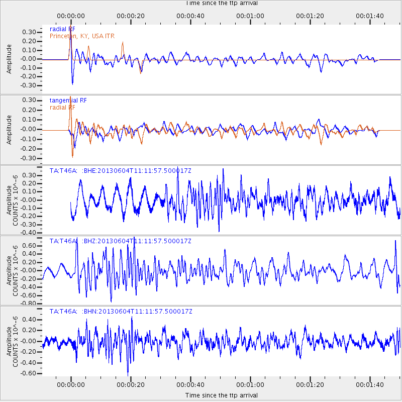
T46A Princeton, KY, USA - Earthquake Result Viewer
*The percent match for this event was below the threshold and hence no stack was calculated.
| Earthquake location: |
Kuril Islands |
| Earthquake latitude/longitude: |
45.4/150.9 |
| Earthquake time(UTC): |
2013/06/04 (155) 11:00:09 GMT |
| Earthquake Depth: |
24 km |
| Earthquake Magnitude: |
5.6 MW, 5.5 MW |
| Earthquake Catalog/Contributor: |
NEIC PDE/NEIC PDE-W |
|
| Network: |
TA USArray Transportable Network (new EarthScope stations) |
| Station: |
T46A Princeton, KY, USA |
| Lat/Lon: |
37.04 N/87.89 W |
| Elevation: |
169 m |
|
| Distance: |
82.3 deg |
| Az: |
43.684 deg |
| Baz: |
322.527 deg |
| Ray Param: |
$rayparam |
*The percent match for this event was below the threshold and hence was not used in the summary stack. |
|
| Radial Match: |
60.42474 % |
| Radial Bump: |
400 |
| Transverse Match: |
59.625187 % |
| Transverse Bump: |
400 |
| SOD ConfigId: |
512894 |
| Insert Time: |
2013-09-14 23:56:43.565 +0000 |
| GWidth: |
2.5 |
| Max Bumps: |
400 |
| Tol: |
0.001 |
|
Signal To Noise
| Channel | StoN | STA | LTA |
| TA:T46A: :BHZ:20130604T11:11:57.500017Z | 2.4447997 | 2.811552E-7 | 1.1500133E-7 |
| TA:T46A: :BHN:20130604T11:11:57.500017Z | 1.3876588 | 1.0865178E-7 | 7.8298626E-8 |
| TA:T46A: :BHE:20130604T11:11:57.500017Z | 0.76205933 | 9.4066216E-8 | 1.2343686E-7 |
| Arrivals |
| Ps | |
| PpPs | |
| PsPs/PpSs | |


