You are here: Home > Network List > TA - USArray Transportable Network (new EarthScope stations) Stations List
> Station T47A Sharon Grove, KY, USA > Earthquake Result Viewer
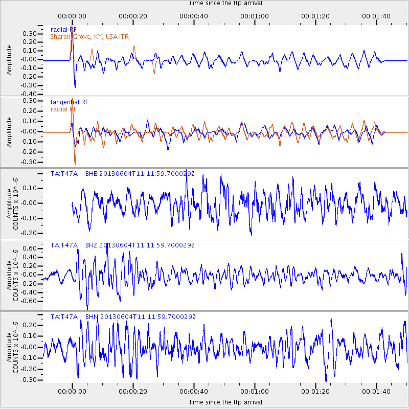
T47A Sharon Grove, KY, USA - Earthquake Result Viewer
*The percent match for this event was below the threshold and hence no stack was calculated.
| Earthquake location: |
Kuril Islands |
| Earthquake latitude/longitude: |
45.4/150.9 |
| Earthquake time(UTC): |
2013/06/04 (155) 11:00:09 GMT |
| Earthquake Depth: |
24 km |
| Earthquake Magnitude: |
5.6 MW, 5.5 MW |
| Earthquake Catalog/Contributor: |
NEIC PDE/NEIC PDE-W |
|
| Network: |
TA USArray Transportable Network (new EarthScope stations) |
| Station: |
T47A Sharon Grove, KY, USA |
| Lat/Lon: |
36.99 N/87.11 W |
| Elevation: |
217 m |
|
| Distance: |
82.8 deg |
| Az: |
43.21 deg |
| Baz: |
322.938 deg |
| Ray Param: |
$rayparam |
*The percent match for this event was below the threshold and hence was not used in the summary stack. |
|
| Radial Match: |
73.04463 % |
| Radial Bump: |
400 |
| Transverse Match: |
56.57058 % |
| Transverse Bump: |
388 |
| SOD ConfigId: |
512894 |
| Insert Time: |
2013-09-14 23:56:45.222 +0000 |
| GWidth: |
2.5 |
| Max Bumps: |
400 |
| Tol: |
0.001 |
|
Signal To Noise
| Channel | StoN | STA | LTA |
| TA:T47A: :BHZ:20130604T11:11:59.700029Z | 3.398009 | 2.9493273E-7 | 8.6795744E-8 |
| TA:T47A: :BHN:20130604T11:11:59.700029Z | 1.8014121 | 1.2588916E-7 | 6.98836E-8 |
| TA:T47A: :BHE:20130604T11:11:59.700029Z | 1.004964 | 6.3136014E-8 | 6.282416E-8 |
| Arrivals |
| Ps | |
| PpPs | |
| PsPs/PpSs | |


