You are here: Home > Network List > TA - USArray Transportable Network (new EarthScope stations) Stations List
> Station V57A Coltrane Farms, NC, USA > Earthquake Result Viewer
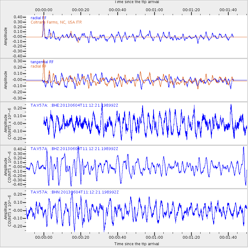
V57A Coltrane Farms, NC, USA - Earthquake Result Viewer
*The percent match for this event was below the threshold and hence no stack was calculated.
| Earthquake location: |
Kuril Islands |
| Earthquake latitude/longitude: |
45.4/150.9 |
| Earthquake time(UTC): |
2013/06/04 (155) 11:00:09 GMT |
| Earthquake Depth: |
24 km |
| Earthquake Magnitude: |
5.6 MW, 5.5 MW |
| Earthquake Catalog/Contributor: |
NEIC PDE/NEIC PDE-W |
|
| Network: |
TA USArray Transportable Network (new EarthScope stations) |
| Station: |
V57A Coltrane Farms, NC, USA |
| Lat/Lon: |
35.89 N/79.78 W |
| Elevation: |
223 m |
|
| Distance: |
87.0 deg |
| Az: |
38.989 deg |
| Baz: |
326.901 deg |
| Ray Param: |
$rayparam |
*The percent match for this event was below the threshold and hence was not used in the summary stack. |
|
| Radial Match: |
59.730465 % |
| Radial Bump: |
400 |
| Transverse Match: |
54.583385 % |
| Transverse Bump: |
400 |
| SOD ConfigId: |
512894 |
| Insert Time: |
2013-09-14 23:58:51.052 +0000 |
| GWidth: |
2.5 |
| Max Bumps: |
400 |
| Tol: |
0.001 |
|
Signal To Noise
| Channel | StoN | STA | LTA |
| TA:V57A: :BHZ:20130604T11:12:21.198992Z | 3.033382 | 1.9391761E-7 | 6.3927864E-8 |
| TA:V57A: :BHN:20130604T11:12:21.198992Z | 1.2427219 | 8.451168E-8 | 6.8005306E-8 |
| TA:V57A: :BHE:20130604T11:12:21.198992Z | 1.8503652 | 1.106177E-7 | 5.978155E-8 |
| Arrivals |
| Ps | |
| PpPs | |
| PsPs/PpSs | |


