You are here: Home > Network List > US - United States National Seismic Network Stations List
> Station AMTX Amarillo, Texas, USA > Earthquake Result Viewer
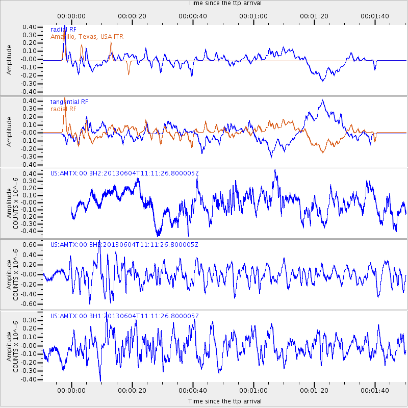
AMTX Amarillo, Texas, USA - Earthquake Result Viewer
*The percent match for this event was below the threshold and hence no stack was calculated.
| Earthquake location: |
Kuril Islands |
| Earthquake latitude/longitude: |
45.4/150.9 |
| Earthquake time(UTC): |
2013/06/04 (155) 11:00:09 GMT |
| Earthquake Depth: |
24 km |
| Earthquake Magnitude: |
5.6 MW, 5.5 MW |
| Earthquake Catalog/Contributor: |
NEIC PDE/NEIC PDE-W |
|
| Network: |
US United States National Seismic Network |
| Station: |
AMTX Amarillo, Texas, USA |
| Lat/Lon: |
34.53 N/101.41 W |
| Elevation: |
1010 m |
|
| Distance: |
77.1 deg |
| Az: |
53.812 deg |
| Baz: |
316.45 deg |
| Ray Param: |
$rayparam |
*The percent match for this event was below the threshold and hence was not used in the summary stack. |
|
| Radial Match: |
49.123596 % |
| Radial Bump: |
400 |
| Transverse Match: |
43.73179 % |
| Transverse Bump: |
400 |
| SOD ConfigId: |
512894 |
| Insert Time: |
2013-09-15 00:02:02.255 +0000 |
| GWidth: |
2.5 |
| Max Bumps: |
400 |
| Tol: |
0.001 |
|
Signal To Noise
| Channel | StoN | STA | LTA |
| US:AMTX:00:BHZ:20130604T11:11:26.800005Z | 1.6053216 | 1.9850681E-7 | 1.2365547E-7 |
| US:AMTX:00:BH1:20130604T11:11:26.800005Z | 0.7941418 | 8.399153E-8 | 1.0576389E-7 |
| US:AMTX:00:BH2:20130604T11:11:26.800005Z | 2.6426997 | 2.7945603E-7 | 1.05746416E-7 |
| Arrivals |
| Ps | |
| PpPs | |
| PsPs/PpSs | |


