You are here: Home > Network List > UW - Pacific Northwest Regional Seismic Network Stations List
> Station FISH Seaside, OR, USA > Earthquake Result Viewer
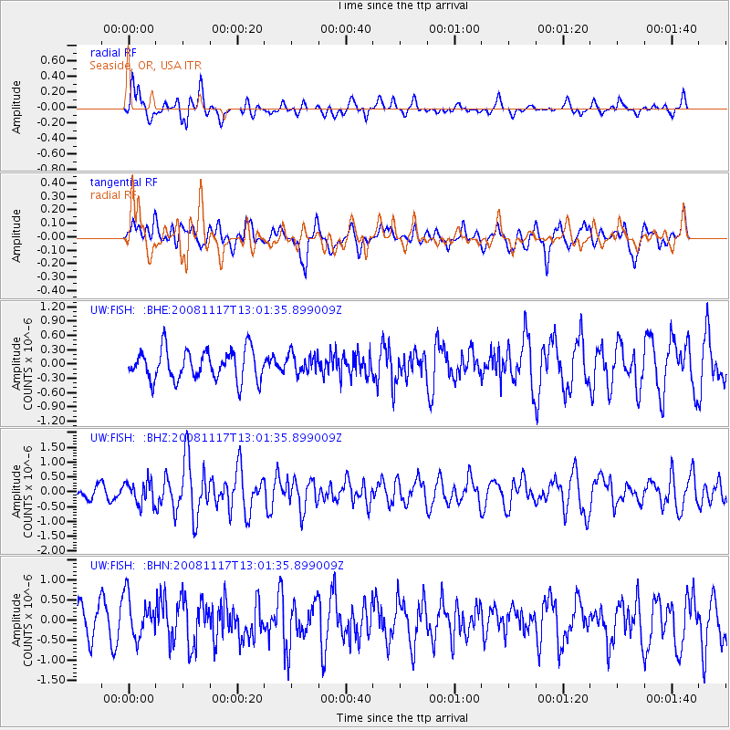
FISH Seaside, OR, USA - Earthquake Result Viewer
*The percent match for this event was below the threshold and hence no stack was calculated.
| Earthquake location: |
Arctic Ocean |
| Earthquake latitude/longitude: |
79.6/-116.1 |
| Earthquake time(UTC): |
2008/11/17 (322) 12:55:22 GMT |
| Earthquake Depth: |
7.0 km |
| Earthquake Magnitude: |
5.7 MW, 5.2 MS, 5.4 MB, 5.7 MW |
| Earthquake Catalog/Contributor: |
WHDF/NEIC |
|
| Network: |
UW Pacific Northwest Regional Seismic Network |
| Station: |
FISH Seaside, OR, USA |
| Lat/Lon: |
45.93 N/123.56 W |
| Elevation: |
325 m |
|
| Distance: |
34.0 deg |
| Az: |
189.391 deg |
| Baz: |
2.424 deg |
| Ray Param: |
$rayparam |
*The percent match for this event was below the threshold and hence was not used in the summary stack. |
|
| Radial Match: |
59.62905 % |
| Radial Bump: |
400 |
| Transverse Match: |
61.80345 % |
| Transverse Bump: |
400 |
| SOD ConfigId: |
2658 |
| Insert Time: |
2010-02-27 04:17:06.413 +0000 |
| GWidth: |
2.5 |
| Max Bumps: |
400 |
| Tol: |
0.001 |
|
Signal To Noise
| Channel | StoN | STA | LTA |
| UW:FISH: :BHZ:20081117T13:01:35.899009Z | 2.0314791 | 3.8969682E-7 | 1.918291E-7 |
| UW:FISH: :BHN:20081117T13:01:35.899009Z | 1.5972414 | 5.303927E-7 | 3.32068E-7 |
| UW:FISH: :BHE:20081117T13:01:35.899009Z | 0.66800356 | 2.1075947E-7 | 3.1550653E-7 |
| Arrivals |
| Ps | |
| PpPs | |
| PsPs/PpSs | |


