You are here: Home > Network List > UW - Pacific Northwest Regional Seismic Network Stations List
> Station FISH Seaside, OR, USA > Earthquake Result Viewer
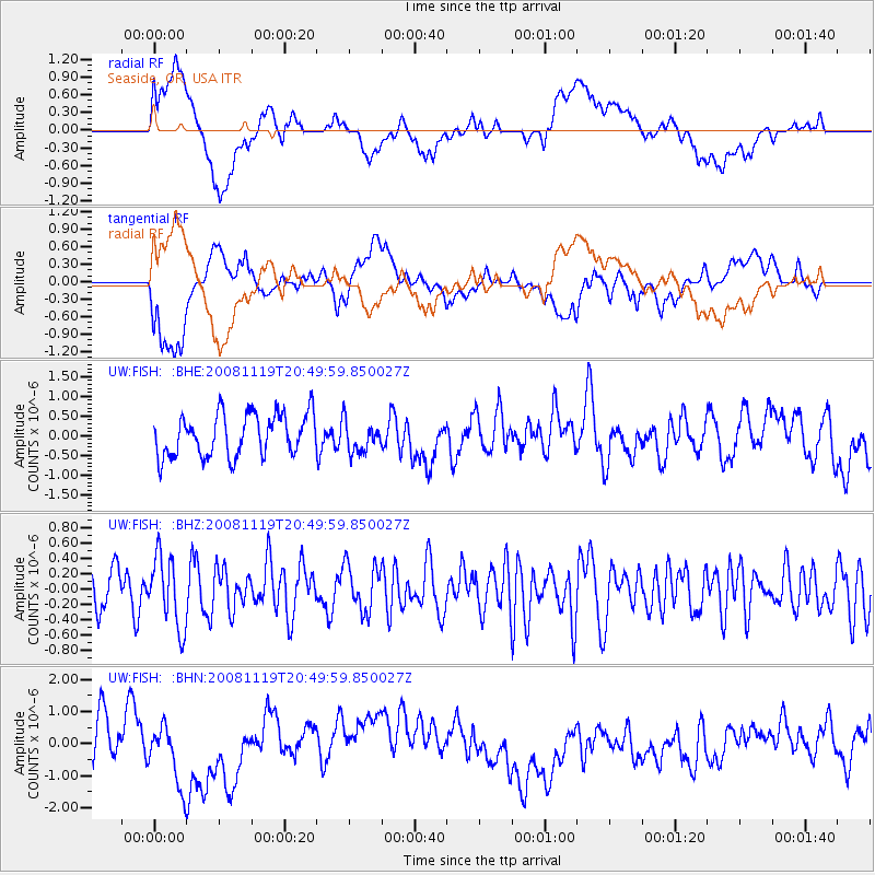
FISH Seaside, OR, USA - Earthquake Result Viewer
*The percent match for this event was below the threshold and hence no stack was calculated.
| Earthquake location: |
South Of Fiji Islands |
| Earthquake latitude/longitude: |
-22.2/-179.7 |
| Earthquake time(UTC): |
2008/11/19 (324) 20:38:58 GMT |
| Earthquake Depth: |
596 km |
| Earthquake Magnitude: |
5.8 MW, 5.2 MB, 5.8 MW |
| Earthquake Catalog/Contributor: |
WHDF/NEIC |
|
| Network: |
UW Pacific Northwest Regional Seismic Network |
| Station: |
FISH Seaside, OR, USA |
| Lat/Lon: |
45.93 N/123.56 W |
| Elevation: |
325 m |
|
| Distance: |
84.7 deg |
| Az: |
35.601 deg |
| Baz: |
230.639 deg |
| Ray Param: |
$rayparam |
*The percent match for this event was below the threshold and hence was not used in the summary stack. |
|
| Radial Match: |
56.35744 % |
| Radial Bump: |
400 |
| Transverse Match: |
45.265385 % |
| Transverse Bump: |
400 |
| SOD ConfigId: |
2658 |
| Insert Time: |
2010-02-27 04:17:07.092 +0000 |
| GWidth: |
2.5 |
| Max Bumps: |
400 |
| Tol: |
0.001 |
|
Signal To Noise
| Channel | StoN | STA | LTA |
| UW:FISH: :BHZ:20081119T20:49:59.850027Z | 1.5131941 | 4.6452982E-7 | 3.0698627E-7 |
| UW:FISH: :BHN:20081119T20:49:59.850027Z | 1.0189466 | 1.1573999E-6 | 1.1358788E-6 |
| UW:FISH: :BHE:20081119T20:49:59.850027Z | 0.73126274 | 3.9202916E-7 | 5.360989E-7 |
| Arrivals |
| Ps | |
| PpPs | |
| PsPs/PpSs | |


