You are here: Home > Network List > TA - USArray Transportable Network (new EarthScope stations) Stations List
> Station O03E Paynes Creek, CA, USA > Earthquake Result Viewer
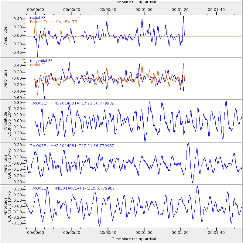
O03E Paynes Creek, CA, USA - Earthquake Result Viewer
*The percent match for this event was below the threshold and hence no stack was calculated.
| Earthquake location: |
Ryukyu Islands, Japan |
| Earthquake latitude/longitude: |
28.1/128.1 |
| Earthquake time(UTC): |
2014/08/14 (226) 17:09:46 GMT |
| Earthquake Depth: |
0.0 km |
| Earthquake Magnitude: |
4.4 mb, 3.5 ML, 4.4 mb1mx, 4.9 MS, 4.9 Ms1, 4.9 ms1mx, 4.5 mb1, 4.4 mbtmp |
| Earthquake Catalog/Contributor: |
ISC/ISC |
|
| Network: |
TA USArray Transportable Network (new EarthScope stations) |
| Station: |
O03E Paynes Creek, CA, USA |
| Lat/Lon: |
40.29 N/121.80 W |
| Elevation: |
967 m |
|
| Distance: |
86.0 deg |
| Az: |
46.056 deg |
| Baz: |
303.716 deg |
| Ray Param: |
$rayparam |
*The percent match for this event was below the threshold and hence was not used in the summary stack. |
|
| Radial Match: |
49.655895 % |
| Radial Bump: |
400 |
| Transverse Match: |
55.245842 % |
| Transverse Bump: |
400 |
| SOD ConfigId: |
3390531 |
| Insert Time: |
2019-04-13 09:28:15.418 +0000 |
| GWidth: |
2.5 |
| Max Bumps: |
400 |
| Tol: |
0.001 |
|
Signal To Noise
| Channel | StoN | STA | LTA |
| TA:O03E: :HHZ:20140814T17:21:56.77998Z | 1.4152563 | 1.4047686E-7 | 9.9258955E-8 |
| TA:O03E: :HHN:20140814T17:21:56.77998Z | 1.418743 | 1.6935688E-7 | 1.1937108E-7 |
| TA:O03E: :HHE:20140814T17:21:56.77998Z | 0.54823834 | 7.270948E-8 | 1.3262385E-7 |
| Arrivals |
| Ps | |
| PpPs | |
| PsPs/PpSs | |


