You are here: Home > Network List > UW - Pacific Northwest Regional Seismic Network Stations List
> Station FISH Seaside, OR, USA > Earthquake Result Viewer
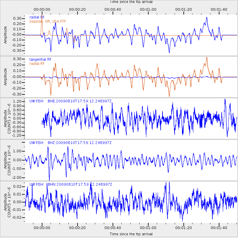
FISH Seaside, OR, USA - Earthquake Result Viewer
*The percent match for this event was below the threshold and hence no stack was calculated.
| Earthquake location: |
Near N Coast Of New Guinea, P.N.G. |
| Earthquake latitude/longitude: |
-3.1/143.2 |
| Earthquake time(UTC): |
2009/08/10 (222) 17:46:23 GMT |
| Earthquake Depth: |
10 km |
| Earthquake Magnitude: |
5.9 MB, 5.6 MW, 5.6 MW |
| Earthquake Catalog/Contributor: |
WHDF/NEIC |
|
| Network: |
UW Pacific Northwest Regional Seismic Network |
| Station: |
FISH Seaside, OR, USA |
| Lat/Lon: |
45.93 N/123.56 W |
| Elevation: |
325 m |
|
| Distance: |
94.5 deg |
| Az: |
44.344 deg |
| Baz: |
270.149 deg |
| Ray Param: |
$rayparam |
*The percent match for this event was below the threshold and hence was not used in the summary stack. |
|
| Radial Match: |
51.474483 % |
| Radial Bump: |
400 |
| Transverse Match: |
50.022736 % |
| Transverse Bump: |
400 |
| SOD ConfigId: |
2622 |
| Insert Time: |
2010-02-27 04:17:12.826 +0000 |
| GWidth: |
2.5 |
| Max Bumps: |
400 |
| Tol: |
0.001 |
|
Signal To Noise
| Channel | StoN | STA | LTA |
| UW:FISH: :BHZ:20090810T17:59:12.248997Z | 2.2866817 | 7.6897896E-7 | 3.3628598E-7 |
| UW:FISH: :BHN:20090810T17:59:12.248997Z | 1.1007985 | 8.35151E-9 | 7.586774E-9 |
| UW:FISH: :BHE:20090810T17:59:12.248997Z | 1.2497138 | 4.4705232E-7 | 3.5772376E-7 |
| Arrivals |
| Ps | |
| PpPs | |
| PsPs/PpSs | |


