You are here: Home > Network List > UW - Pacific Northwest Regional Seismic Network Stations List
> Station FISH Seaside, OR, USA > Earthquake Result Viewer
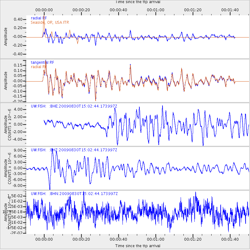
FISH Seaside, OR, USA - Earthquake Result Viewer
*The percent match for this event was below the threshold and hence no stack was calculated.
| Earthquake location: |
Samoa Islands Region |
| Earthquake latitude/longitude: |
-15.2/-172.6 |
| Earthquake time(UTC): |
2009/08/30 (242) 14:51:32 GMT |
| Earthquake Depth: |
11 km |
| Earthquake Magnitude: |
6.4 MB, 6.3 MS, 6.6 MW, 6.6 MW |
| Earthquake Catalog/Contributor: |
WHDF/NEIC |
|
| Network: |
UW Pacific Northwest Regional Seismic Network |
| Station: |
FISH Seaside, OR, USA |
| Lat/Lon: |
45.93 N/123.56 W |
| Elevation: |
325 m |
|
| Distance: |
75.2 deg |
| Az: |
33.015 deg |
| Baz: |
228.905 deg |
| Ray Param: |
$rayparam |
*The percent match for this event was below the threshold and hence was not used in the summary stack. |
|
| Radial Match: |
84.0194 % |
| Radial Bump: |
400 |
| Transverse Match: |
83.991005 % |
| Transverse Bump: |
400 |
| SOD ConfigId: |
2622 |
| Insert Time: |
2010-02-27 04:17:17.747 +0000 |
| GWidth: |
2.5 |
| Max Bumps: |
400 |
| Tol: |
0.001 |
|
Signal To Noise
| Channel | StoN | STA | LTA |
| UW:FISH: :BHZ:20090830T15:02:44.173997Z | 12.7550745 | 4.78366E-6 | 3.7503978E-7 |
| UW:FISH: :BHN:20090830T15:02:44.173997Z | 1.0045533 | 6.129957E-9 | 6.102172E-9 |
| UW:FISH: :BHE:20090830T15:02:44.173997Z | 2.2298775 | 1.3043104E-6 | 5.8492475E-7 |
| Arrivals |
| Ps | |
| PpPs | |
| PsPs/PpSs | |


