You are here: Home > Network List > TA - USArray Transportable Network (new EarthScope stations) Stations List
> Station R11A Troy Canyon, Currant, NV, USA > Earthquake Result Viewer
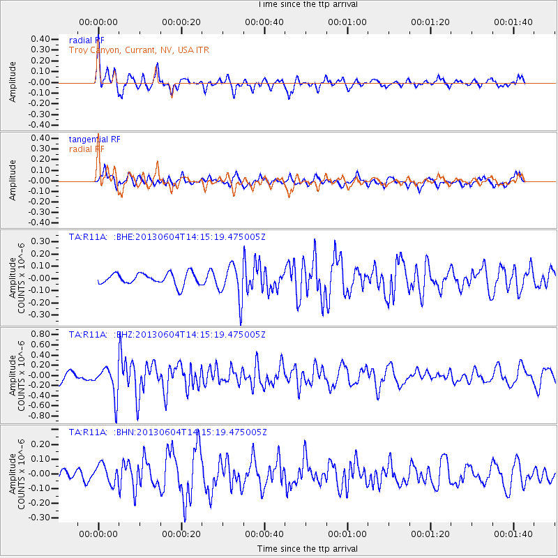
R11A Troy Canyon, Currant, NV, USA - Earthquake Result Viewer
*The percent match for this event was below the threshold and hence no stack was calculated.
| Earthquake location: |
Mariana Islands |
| Earthquake latitude/longitude: |
17.0/145.8 |
| Earthquake time(UTC): |
2013/06/04 (155) 14:03:10 GMT |
| Earthquake Depth: |
16 km |
| Earthquake Magnitude: |
5.5 MW, 5.8 MB |
| Earthquake Catalog/Contributor: |
NEIC PDE/NEIC PDE-W |
|
| Network: |
TA USArray Transportable Network (new EarthScope stations) |
| Station: |
R11A Troy Canyon, Currant, NV, USA |
| Lat/Lon: |
38.35 N/115.59 W |
| Elevation: |
1756 m |
|
| Distance: |
86.2 deg |
| Az: |
51.188 deg |
| Baz: |
288.498 deg |
| Ray Param: |
$rayparam |
*The percent match for this event was below the threshold and hence was not used in the summary stack. |
|
| Radial Match: |
72.580574 % |
| Radial Bump: |
400 |
| Transverse Match: |
71.1254 % |
| Transverse Bump: |
400 |
| SOD ConfigId: |
512894 |
| Insert Time: |
2013-09-15 00:25:21.736 +0000 |
| GWidth: |
2.5 |
| Max Bumps: |
400 |
| Tol: |
0.001 |
|
Signal To Noise
| Channel | StoN | STA | LTA |
| TA:R11A: :BHZ:20130604T14:15:19.475005Z | 2.64268 | 3.036079E-7 | 1.1488636E-7 |
| TA:R11A: :BHN:20130604T14:15:19.475005Z | 1.6718398 | 6.876624E-8 | 4.1132076E-8 |
| TA:R11A: :BHE:20130604T14:15:19.475005Z | 3.0875957 | 1.4571377E-7 | 4.7193282E-8 |
| Arrivals |
| Ps | |
| PpPs | |
| PsPs/PpSs | |


