You are here: Home > Network List > US - United States National Seismic Network Stations List
> Station HAWA Hanford, Washington, USA > Earthquake Result Viewer
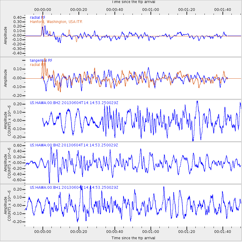
HAWA Hanford, Washington, USA - Earthquake Result Viewer
*The percent match for this event was below the threshold and hence no stack was calculated.
| Earthquake location: |
Mariana Islands |
| Earthquake latitude/longitude: |
17.0/145.8 |
| Earthquake time(UTC): |
2013/06/04 (155) 14:03:10 GMT |
| Earthquake Depth: |
16 km |
| Earthquake Magnitude: |
5.5 MW, 5.8 MB |
| Earthquake Catalog/Contributor: |
NEIC PDE/NEIC PDE-W |
|
| Network: |
US United States National Seismic Network |
| Station: |
HAWA Hanford, Washington, USA |
| Lat/Lon: |
46.39 N/119.53 W |
| Elevation: |
364 m |
|
| Distance: |
81.0 deg |
| Az: |
44.3 deg |
| Baz: |
285.07 deg |
| Ray Param: |
$rayparam |
*The percent match for this event was below the threshold and hence was not used in the summary stack. |
|
| Radial Match: |
58.43743 % |
| Radial Bump: |
400 |
| Transverse Match: |
57.74637 % |
| Transverse Bump: |
400 |
| SOD ConfigId: |
512894 |
| Insert Time: |
2013-09-15 00:26:10.651 +0000 |
| GWidth: |
2.5 |
| Max Bumps: |
400 |
| Tol: |
0.001 |
|
Signal To Noise
| Channel | StoN | STA | LTA |
| US:HAWA:00:BHZ:20130604T14:14:53.250029Z | 3.720699 | 2.6735853E-7 | 7.1857066E-8 |
| US:HAWA:00:BH1:20130604T14:14:53.250029Z | 1.6724278 | 6.981168E-8 | 4.174272E-8 |
| US:HAWA:00:BH2:20130604T14:14:53.250029Z | 0.915117 | 7.3116105E-8 | 7.989809E-8 |
| Arrivals |
| Ps | |
| PpPs | |
| PsPs/PpSs | |


