You are here: Home > Network List > US - United States National Seismic Network Stations List
> Station MSO Missoula, Montana, USA > Earthquake Result Viewer
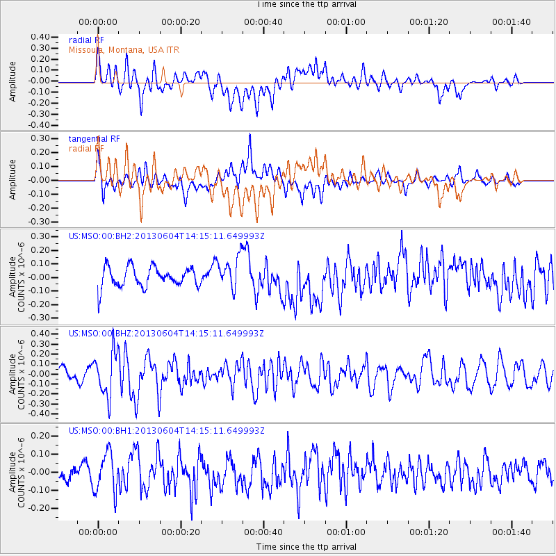
MSO Missoula, Montana, USA - Earthquake Result Viewer
*The percent match for this event was below the threshold and hence no stack was calculated.
| Earthquake location: |
Mariana Islands |
| Earthquake latitude/longitude: |
17.0/145.8 |
| Earthquake time(UTC): |
2013/06/04 (155) 14:03:10 GMT |
| Earthquake Depth: |
16 km |
| Earthquake Magnitude: |
5.5 MW, 5.8 MB |
| Earthquake Catalog/Contributor: |
NEIC PDE/NEIC PDE-W |
|
| Network: |
US United States National Seismic Network |
| Station: |
MSO Missoula, Montana, USA |
| Lat/Lon: |
46.83 N/113.94 W |
| Elevation: |
1264 m |
|
| Distance: |
84.6 deg |
| Az: |
42.744 deg |
| Baz: |
288.927 deg |
| Ray Param: |
$rayparam |
*The percent match for this event was below the threshold and hence was not used in the summary stack. |
|
| Radial Match: |
48.598625 % |
| Radial Bump: |
400 |
| Transverse Match: |
57.618763 % |
| Transverse Bump: |
400 |
| SOD ConfigId: |
512894 |
| Insert Time: |
2013-09-15 00:26:24.893 +0000 |
| GWidth: |
2.5 |
| Max Bumps: |
400 |
| Tol: |
0.001 |
|
Signal To Noise
| Channel | StoN | STA | LTA |
| US:MSO:00:BHZ:20130604T14:15:11.649993Z | 2.730322 | 2.27808E-7 | 8.343632E-8 |
| US:MSO:00:BH1:20130604T14:15:11.649993Z | 2.4127588 | 1.10715646E-7 | 4.588757E-8 |
| US:MSO:00:BH2:20130604T14:15:11.649993Z | 1.6438748 | 1.2163879E-7 | 7.3995174E-8 |
| Arrivals |
| Ps | |
| PpPs | |
| PsPs/PpSs | |


