You are here: Home > Network List > TA - USArray Transportable Network (new EarthScope stations) Stations List
> Station O03E Paynes Creek, CA, USA > Earthquake Result Viewer
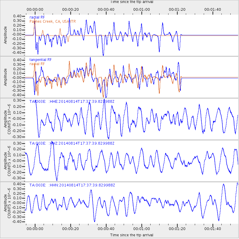
O03E Paynes Creek, CA, USA - Earthquake Result Viewer
*The percent match for this event was below the threshold and hence no stack was calculated.
| Earthquake location: |
E. Caroline Islands, Micronesia |
| Earthquake latitude/longitude: |
0.9/146.1 |
| Earthquake time(UTC): |
2014/08/14 (226) 17:25:06 GMT |
| Earthquake Depth: |
9.4 km |
| Earthquake Magnitude: |
4.8 MW, 4.9 mb |
| Earthquake Catalog/Contributor: |
ISC/ISC |
|
| Network: |
TA USArray Transportable Network (new EarthScope stations) |
| Station: |
O03E Paynes Creek, CA, USA |
| Lat/Lon: |
40.29 N/121.80 W |
| Elevation: |
967 m |
|
| Distance: |
91.1 deg |
| Az: |
49.86 deg |
| Baz: |
272.028 deg |
| Ray Param: |
$rayparam |
*The percent match for this event was below the threshold and hence was not used in the summary stack. |
|
| Radial Match: |
53.419243 % |
| Radial Bump: |
400 |
| Transverse Match: |
53.961407 % |
| Transverse Bump: |
400 |
| SOD ConfigId: |
3390531 |
| Insert Time: |
2019-04-13 09:34:29.411 +0000 |
| GWidth: |
2.5 |
| Max Bumps: |
400 |
| Tol: |
0.001 |
|
Signal To Noise
| Channel | StoN | STA | LTA |
| TA:O03E: :HHZ:20140814T17:37:39.829988Z | 2.254687 | 1.5629898E-7 | 6.9321814E-8 |
| TA:O03E: :HHN:20140814T17:37:39.829988Z | 0.96757174 | 1.2134345E-7 | 1.2541028E-7 |
| TA:O03E: :HHE:20140814T17:37:39.829988Z | 1.5805053 | 1.7945777E-7 | 1.1354456E-7 |
| Arrivals |
| Ps | |
| PpPs | |
| PsPs/PpSs | |


