You are here: Home > Network List > UW - Pacific Northwest Regional Seismic Network Stations List
> Station FISH Seaside, OR, USA > Earthquake Result Viewer
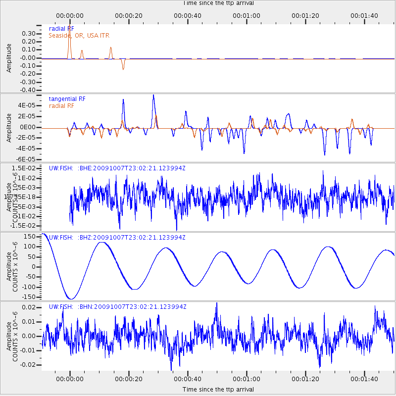
FISH Seaside, OR, USA - Earthquake Result Viewer
*The percent match for this event was below the threshold and hence no stack was calculated.
| Earthquake location: |
Santa Cruz Islands |
| Earthquake latitude/longitude: |
-12.4/166.1 |
| Earthquake time(UTC): |
2009/10/07 (280) 22:50:15 GMT |
| Earthquake Depth: |
21 km |
| Earthquake Magnitude: |
5.8 MB |
| Earthquake Catalog/Contributor: |
WHDF/NEIC |
|
| Network: |
UW Pacific Northwest Regional Seismic Network |
| Station: |
FISH Seaside, OR, USA |
| Lat/Lon: |
45.93 N/123.56 W |
| Elevation: |
325 m |
|
| Distance: |
85.6 deg |
| Az: |
41.243 deg |
| Baz: |
247.346 deg |
| Ray Param: |
$rayparam |
*The percent match for this event was below the threshold and hence was not used in the summary stack. |
|
| Radial Match: |
32.665703 % |
| Radial Bump: |
400 |
| Transverse Match: |
37.752922 % |
| Transverse Bump: |
400 |
| SOD ConfigId: |
2622 |
| Insert Time: |
2010-02-27 04:17:37.531 +0000 |
| GWidth: |
2.5 |
| Max Bumps: |
400 |
| Tol: |
0.001 |
|
Signal To Noise
| Channel | StoN | STA | LTA |
| UW:FISH: :BHZ:20091007T23:02:21.123994Z | 1.3612465 | 1.5475611E-4 | 1.1368706E-4 |
| UW:FISH: :BHN:20091007T23:02:21.123994Z | 0.9696403 | 5.8794534E-9 | 6.063541E-9 |
| UW:FISH: :BHE:20091007T23:02:21.123994Z | 0.95748115 | 4.8599977E-9 | 5.0758158E-9 |
| Arrivals |
| Ps | |
| PpPs | |
| PsPs/PpSs | |


