You are here: Home > Network List > UW - Pacific Northwest Regional Seismic Network Stations List
> Station FISH Seaside, OR, USA > Earthquake Result Viewer
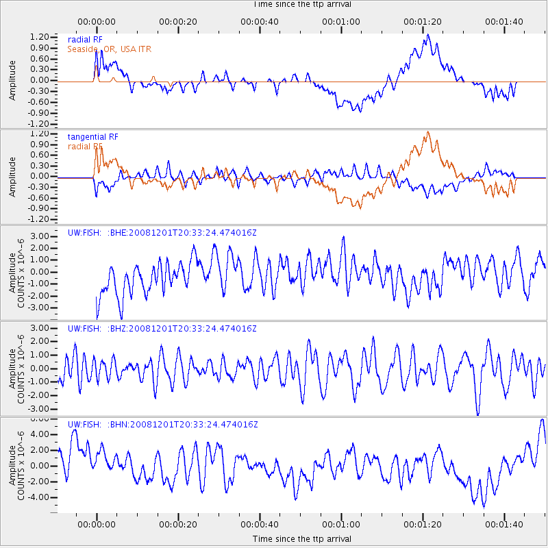
FISH Seaside, OR, USA - Earthquake Result Viewer
*The percent match for this event was below the threshold and hence no stack was calculated.
| Earthquake location: |
Tonga Islands Region |
| Earthquake latitude/longitude: |
-22.9/-175.2 |
| Earthquake time(UTC): |
2008/12/01 (336) 20:21:34 GMT |
| Earthquake Depth: |
39 km |
| Earthquake Magnitude: |
5.5 MB, 5.1 MS |
| Earthquake Catalog/Contributor: |
WHDF/NEIC |
|
| Network: |
UW Pacific Northwest Regional Seismic Network |
| Station: |
FISH Seaside, OR, USA |
| Lat/Lon: |
45.93 N/123.56 W |
| Elevation: |
325 m |
|
| Distance: |
83.0 deg |
| Az: |
33.457 deg |
| Baz: |
226.733 deg |
| Ray Param: |
$rayparam |
*The percent match for this event was below the threshold and hence was not used in the summary stack. |
|
| Radial Match: |
33.220573 % |
| Radial Bump: |
400 |
| Transverse Match: |
50.990364 % |
| Transverse Bump: |
400 |
| SOD ConfigId: |
2658 |
| Insert Time: |
2010-02-27 04:18:06.317 +0000 |
| GWidth: |
2.5 |
| Max Bumps: |
400 |
| Tol: |
0.001 |
|
Signal To Noise
| Channel | StoN | STA | LTA |
| UW:FISH: :BHZ:20081201T20:33:24.474016Z | 0.9377679 | 6.7029487E-7 | 7.147769E-7 |
| UW:FISH: :BHN:20081201T20:33:24.474016Z | 0.95488656 | 2.3646971E-6 | 2.4764167E-6 |
| UW:FISH: :BHE:20081201T20:33:24.474016Z | 1.3503958 | 1.7639749E-6 | 1.3062651E-6 |
| Arrivals |
| Ps | |
| PpPs | |
| PsPs/PpSs | |


