You are here: Home > Network List > IU - Global Seismograph Network (GSN - IRIS/USGS) Stations List
> Station RSSD Black Hills, South Dakota, USA > Earthquake Result Viewer
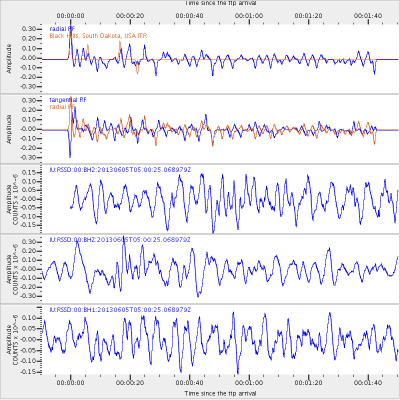
RSSD Black Hills, South Dakota, USA - Earthquake Result Viewer
*The percent match for this event was below the threshold and hence no stack was calculated.
| Earthquake location: |
Santa Cruz Islands |
| Earthquake latitude/longitude: |
-11.4/166.3 |
| Earthquake time(UTC): |
2013/06/05 (156) 04:47:26 GMT |
| Earthquake Depth: |
39 km |
| Earthquake Magnitude: |
6.1 MW, 5.8 MS, 5.9 MB, 6.1 MW |
| Earthquake Catalog/Contributor: |
NEIC PDE/NEIC PDE-W |
|
| Network: |
IU Global Seismograph Network (GSN - IRIS/USGS) |
| Station: |
RSSD Black Hills, South Dakota, USA |
| Lat/Lon: |
44.12 N/104.04 W |
| Elevation: |
2090 m |
|
| Distance: |
97.6 deg |
| Az: |
46.599 deg |
| Baz: |
261.564 deg |
| Ray Param: |
$rayparam |
*The percent match for this event was below the threshold and hence was not used in the summary stack. |
|
| Radial Match: |
61.641373 % |
| Radial Bump: |
400 |
| Transverse Match: |
57.5356 % |
| Transverse Bump: |
370 |
| SOD ConfigId: |
512894 |
| Insert Time: |
2013-09-15 00:43:16.701 +0000 |
| GWidth: |
2.5 |
| Max Bumps: |
400 |
| Tol: |
0.001 |
|
Signal To Noise
| Channel | StoN | STA | LTA |
| IU:RSSD:00:BHZ:20130605T05:00:25.068979Z | 2.5709555 | 1.5954336E-7 | 6.205605E-8 |
| IU:RSSD:00:BH1:20130605T05:00:25.068979Z | 1.122553 | 4.800655E-8 | 4.2765507E-8 |
| IU:RSSD:00:BH2:20130605T05:00:25.068979Z | 1.6400374 | 8.481124E-8 | 5.171299E-8 |
| Arrivals |
| Ps | |
| PpPs | |
| PsPs/PpSs | |


