You are here: Home > Network List > UW - Pacific Northwest Regional Seismic Network Stations List
> Station FISH Seaside, OR, USA > Earthquake Result Viewer
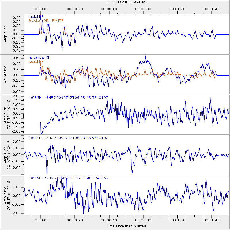
FISH Seaside, OR, USA - Earthquake Result Viewer
*The percent match for this event was below the threshold and hence no stack was calculated.
| Earthquake location: |
Southern Peru |
| Earthquake latitude/longitude: |
-15.0/-70.4 |
| Earthquake time(UTC): |
2009/07/12 (193) 06:12:47 GMT |
| Earthquake Depth: |
199 km |
| Earthquake Magnitude: |
5.7 MB, 6.1 MW, 6.1 MW |
| Earthquake Catalog/Contributor: |
WHDF/NEIC |
|
| Network: |
UW Pacific Northwest Regional Seismic Network |
| Station: |
FISH Seaside, OR, USA |
| Lat/Lon: |
45.93 N/123.56 W |
| Elevation: |
325 m |
|
| Distance: |
77.3 deg |
| Az: |
325.092 deg |
| Baz: |
127.609 deg |
| Ray Param: |
$rayparam |
*The percent match for this event was below the threshold and hence was not used in the summary stack. |
|
| Radial Match: |
77.67076 % |
| Radial Bump: |
400 |
| Transverse Match: |
39.890713 % |
| Transverse Bump: |
400 |
| SOD ConfigId: |
2648 |
| Insert Time: |
2010-02-27 04:19:09.601 +0000 |
| GWidth: |
2.5 |
| Max Bumps: |
400 |
| Tol: |
0.001 |
|
Signal To Noise
| Channel | StoN | STA | LTA |
| UW:FISH: :BHZ:20090712T06:23:48.574019Z | 3.1669636 | 8.432683E-7 | 2.662703E-7 |
| UW:FISH: :BHN:20090712T06:23:48.574019Z | 0.5907794 | 5.709438E-7 | 9.664246E-7 |
| UW:FISH: :BHE:20090712T06:23:48.574019Z | 0.60510445 | 4.333635E-7 | 7.161797E-7 |
| Arrivals |
| Ps | |
| PpPs | |
| PsPs/PpSs | |


