You are here: Home > Network List > TA - USArray Transportable Network (new EarthScope stations) Stations List
> Station O03E Paynes Creek, CA, USA > Earthquake Result Viewer
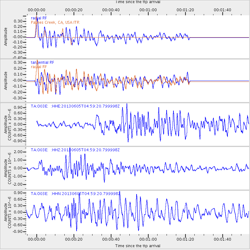
O03E Paynes Creek, CA, USA - Earthquake Result Viewer
*The percent match for this event was below the threshold and hence no stack was calculated.
| Earthquake location: |
Santa Cruz Islands |
| Earthquake latitude/longitude: |
-11.4/166.3 |
| Earthquake time(UTC): |
2013/06/05 (156) 04:47:26 GMT |
| Earthquake Depth: |
39 km |
| Earthquake Magnitude: |
6.1 MW, 5.8 MS, 5.9 MB, 6.1 MW |
| Earthquake Catalog/Contributor: |
NEIC PDE/NEIC PDE-W |
|
| Network: |
TA USArray Transportable Network (new EarthScope stations) |
| Station: |
O03E Paynes Creek, CA, USA |
| Lat/Lon: |
40.29 N/121.80 W |
| Elevation: |
967 m |
|
| Distance: |
83.9 deg |
| Az: |
46.985 deg |
| Baz: |
249.607 deg |
| Ray Param: |
$rayparam |
*The percent match for this event was below the threshold and hence was not used in the summary stack. |
|
| Radial Match: |
64.21612 % |
| Radial Bump: |
400 |
| Transverse Match: |
70.55605 % |
| Transverse Bump: |
400 |
| SOD ConfigId: |
512894 |
| Insert Time: |
2013-09-15 00:49:25.830 +0000 |
| GWidth: |
2.5 |
| Max Bumps: |
400 |
| Tol: |
0.001 |
|
Signal To Noise
| Channel | StoN | STA | LTA |
| TA:O03E: :HHZ:20130605T04:59:20.799998Z | 4.017374 | 4.764295E-7 | 1.1859227E-7 |
| TA:O03E: :HHN:20130605T04:59:20.799998Z | 1.8920839 | 2.2391109E-7 | 1.18341E-7 |
| TA:O03E: :HHE:20130605T04:59:20.799998Z | 3.0778687 | 2.597211E-7 | 8.438342E-8 |
| Arrivals |
| Ps | |
| PpPs | |
| PsPs/PpSs | |


