You are here: Home > Network List > UW - Pacific Northwest Regional Seismic Network Stations List
> Station FISH Seaside, OR, USA > Earthquake Result Viewer
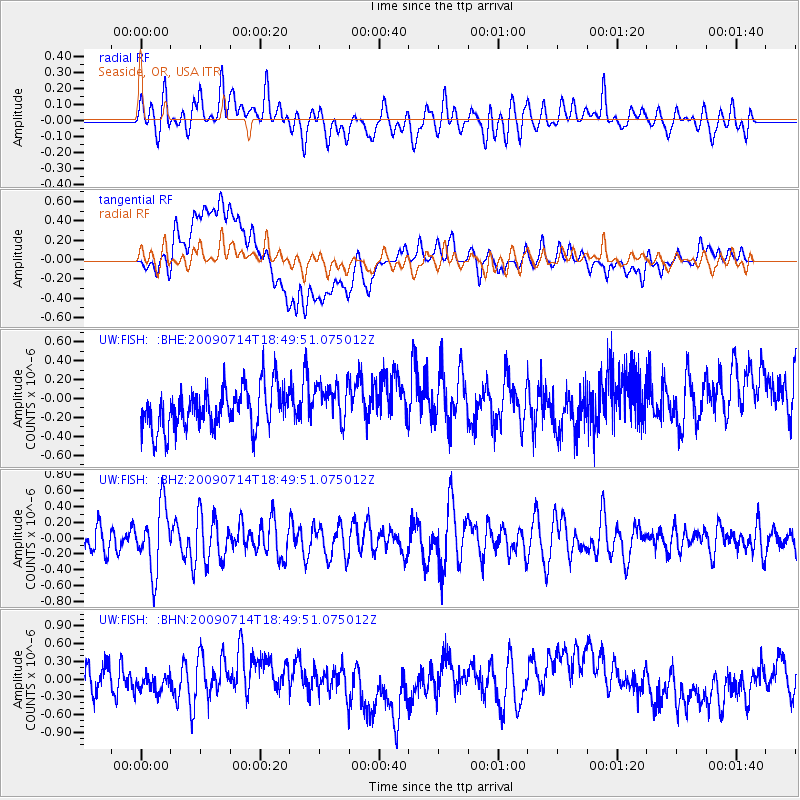
FISH Seaside, OR, USA - Earthquake Result Viewer
*The percent match for this event was below the threshold and hence no stack was calculated.
| Earthquake location: |
Chile-Bolivia Border Region |
| Earthquake latitude/longitude: |
-21.8/-67.1 |
| Earthquake time(UTC): |
2009/07/14 (195) 18:38:08 GMT |
| Earthquake Depth: |
176 km |
| Earthquake Magnitude: |
5.7 MW, 5.4 MB, 5.7 MW |
| Earthquake Catalog/Contributor: |
WHDF/NEIC |
|
| Network: |
UW Pacific Northwest Regional Seismic Network |
| Station: |
FISH Seaside, OR, USA |
| Lat/Lon: |
45.93 N/123.56 W |
| Elevation: |
325 m |
|
| Distance: |
84.6 deg |
| Az: |
324.241 deg |
| Baz: |
128.921 deg |
| Ray Param: |
$rayparam |
*The percent match for this event was below the threshold and hence was not used in the summary stack. |
|
| Radial Match: |
51.985947 % |
| Radial Bump: |
400 |
| Transverse Match: |
47.38293 % |
| Transverse Bump: |
400 |
| SOD ConfigId: |
2648 |
| Insert Time: |
2010-02-27 04:19:14.160 +0000 |
| GWidth: |
2.5 |
| Max Bumps: |
400 |
| Tol: |
0.001 |
|
Signal To Noise
| Channel | StoN | STA | LTA |
| UW:FISH: :BHZ:20090714T18:49:51.075012Z | 2.9255462 | 4.0901972E-7 | 1.398097E-7 |
| UW:FISH: :BHN:20090714T18:49:51.075012Z | 0.50219804 | 1.3908326E-7 | 2.76949E-7 |
| UW:FISH: :BHE:20090714T18:49:51.075012Z | 0.982657 | 2.153046E-7 | 2.1910452E-7 |
| Arrivals |
| Ps | |
| PpPs | |
| PsPs/PpSs | |


