You are here: Home > Network List > IU - Global Seismograph Network (GSN - IRIS/USGS) Stations List
> Station CTAO Charters Towers, Australia > Earthquake Result Viewer
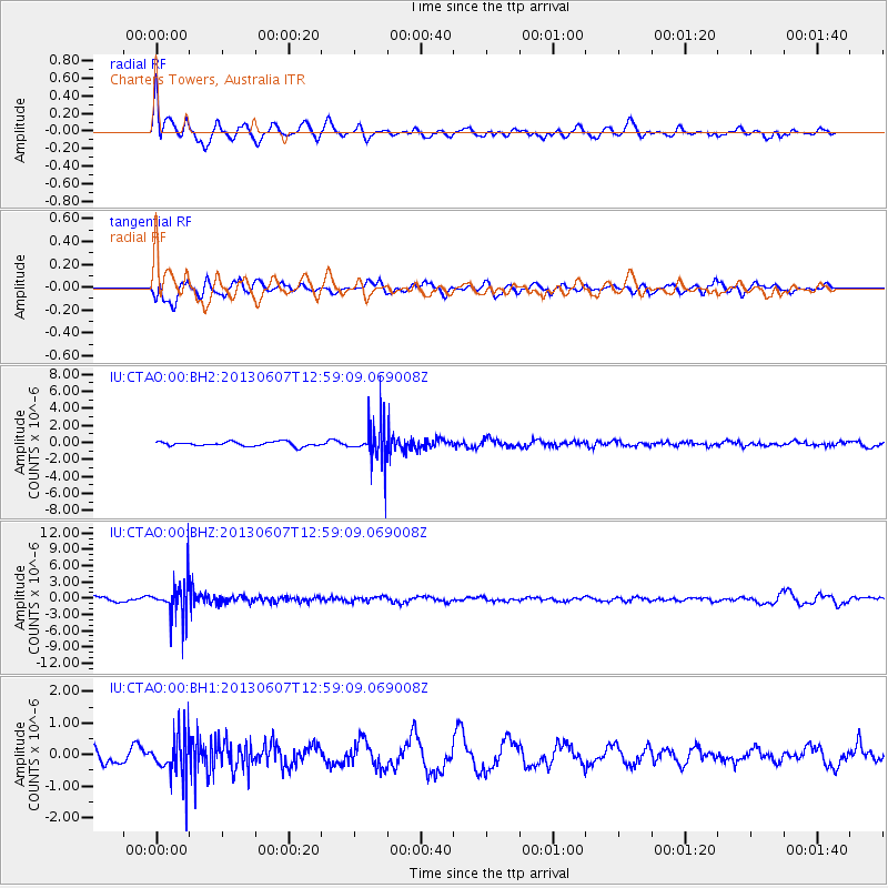
CTAO Charters Towers, Australia - Earthquake Result Viewer
*The percent match for this event was below the threshold and hence no stack was calculated.
| Earthquake location: |
South Of Fiji Islands |
| Earthquake latitude/longitude: |
-23.9/179.1 |
| Earthquake time(UTC): |
2013/06/07 (158) 12:54:09 GMT |
| Earthquake Depth: |
546 km |
| Earthquake Magnitude: |
5.9 MW, 5.5 MB, 5.9 MW |
| Earthquake Catalog/Contributor: |
NEIC PDE/NEIC PDE-W |
|
| Network: |
IU Global Seismograph Network (GSN - IRIS/USGS) |
| Station: |
CTAO Charters Towers, Australia |
| Lat/Lon: |
20.09 S/146.25 E |
| Elevation: |
357 m |
|
| Distance: |
30.6 deg |
| Az: |
270.618 deg |
| Baz: |
103.142 deg |
| Ray Param: |
$rayparam |
*The percent match for this event was below the threshold and hence was not used in the summary stack. |
|
| Radial Match: |
62.81298 % |
| Radial Bump: |
400 |
| Transverse Match: |
65.16999 % |
| Transverse Bump: |
400 |
| SOD ConfigId: |
512894 |
| Insert Time: |
2013-09-15 01:06:44.879 +0000 |
| GWidth: |
2.5 |
| Max Bumps: |
400 |
| Tol: |
0.001 |
|
Signal To Noise
| Channel | StoN | STA | LTA |
| IU:CTAO:00:BHZ:20130607T12:59:09.069008Z | 7.714633 | 3.3510516E-6 | 4.3437603E-7 |
| IU:CTAO:00:BH1:20130607T12:59:09.069008Z | 2.3389504 | 6.5821484E-7 | 2.8141463E-7 |
| IU:CTAO:00:BH2:20130607T12:59:09.069008Z | 9.042871 | 2.249672E-6 | 2.487785E-7 |
| Arrivals |
| Ps | |
| PpPs | |
| PsPs/PpSs | |


