You are here: Home > Network List > US - United States National Seismic Network Stations List
> Station HAWA Hanford, Washington, USA > Earthquake Result Viewer
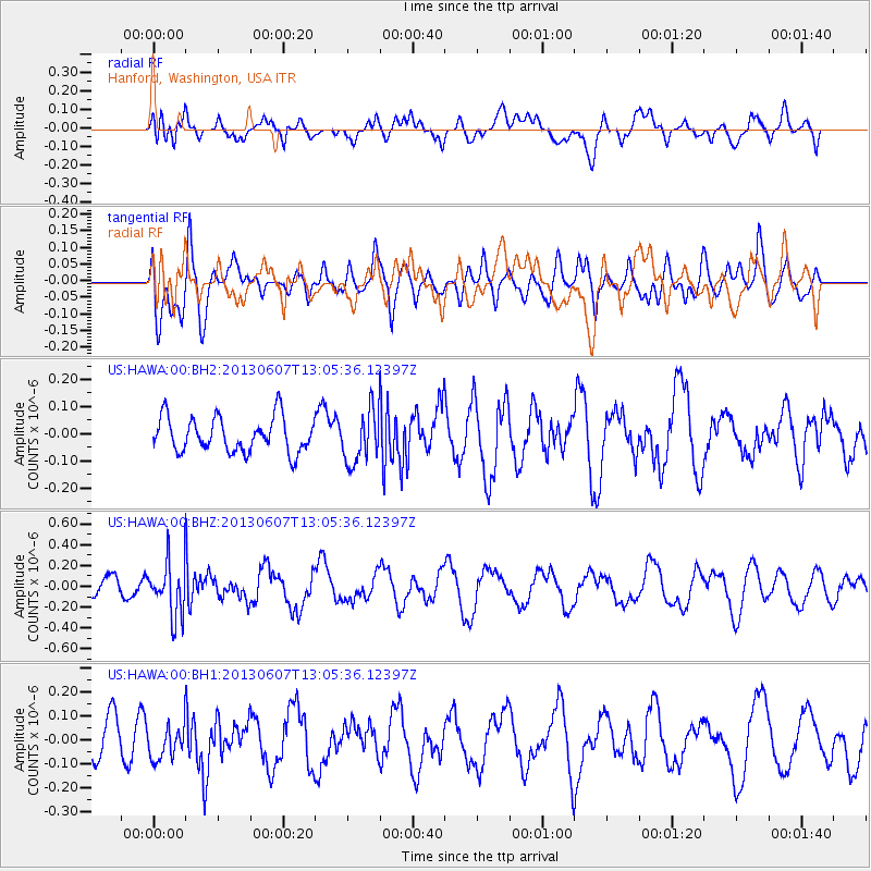
HAWA Hanford, Washington, USA - Earthquake Result Viewer
*The percent match for this event was below the threshold and hence no stack was calculated.
| Earthquake location: |
South Of Fiji Islands |
| Earthquake latitude/longitude: |
-23.9/179.1 |
| Earthquake time(UTC): |
2013/06/07 (158) 12:54:09 GMT |
| Earthquake Depth: |
546 km |
| Earthquake Magnitude: |
5.9 MW, 5.5 MB, 5.9 MW |
| Earthquake Catalog/Contributor: |
NEIC PDE/NEIC PDE-W |
|
| Network: |
US United States National Seismic Network |
| Station: |
HAWA Hanford, Washington, USA |
| Lat/Lon: |
46.39 N/119.53 W |
| Elevation: |
364 m |
|
| Distance: |
89.3 deg |
| Az: |
37.419 deg |
| Baz: |
233.474 deg |
| Ray Param: |
$rayparam |
*The percent match for this event was below the threshold and hence was not used in the summary stack. |
|
| Radial Match: |
43.600277 % |
| Radial Bump: |
400 |
| Transverse Match: |
41.877472 % |
| Transverse Bump: |
400 |
| SOD ConfigId: |
512894 |
| Insert Time: |
2013-09-15 01:14:30.771 +0000 |
| GWidth: |
2.5 |
| Max Bumps: |
400 |
| Tol: |
0.001 |
|
Signal To Noise
| Channel | StoN | STA | LTA |
| US:HAWA:00:BHZ:20130607T13:05:36.12397Z | 3.2331438 | 2.5670923E-7 | 7.9399264E-8 |
| US:HAWA:00:BH1:20130607T13:05:36.12397Z | 0.85226077 | 7.199302E-8 | 8.4472994E-8 |
| US:HAWA:00:BH2:20130607T13:05:36.12397Z | 1.5284163 | 9.685477E-8 | 6.336936E-8 |
| Arrivals |
| Ps | |
| PpPs | |
| PsPs/PpSs | |


