GNW Green Mountain (BB) - Earthquake Result Viewer
Earthquake location: Near Coast Of Peru
Earthquake latitude/longitude: -16.3/-73.6
Earthquake time(UTC): 2001/06/23 (174) 20:33:14 GMT
Earthquake Depth: 33 km
Earthquake Magnitude: 6.7 MB, 8.2 MS, 8.4 MW, 7.8 ME
Earthquake Catalog/Contributor: WHDF/NEIC
Network: UW Pacific Northwest Regional Seismic Network
Station: GNW Green Mountain (BB)
Lat/Lon: 47.56 N/122.83 W
Elevation: 160 m
Distance: 77.3 deg
Az: 328.301 deg
Baz: 131.822 deg
Ray Param: 0.050390083
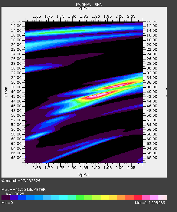
Estimated Moho Depth: 41.25 km
Estimated Crust Vp/Vs: 1.90
Assumed Crust Vp: 6.566 km/s
Estimated Crust Vs: 3.451 km/s
Estimated Crust Poisson's Ratio: 0.31
Radial Match: 97.432526 %
Radial Bump: 189
Transverse Match: 93.40831 %
Transverse Bump: 400
SOD ConfigId: 4714
Insert Time: 2010-02-27 04:19:39.491 +0000
GWidth: 2.5
Max Bumps: 400
Tol: 0.001

Signal To Noise

ChannelStoNSTALTA
UW:GNW: :BHN:20010623T20:44:34.082026Z7.6497884650.673185.05766
UW:GNW: :BHE:20010623T20:44:34.082026Z9.6753435740.499676.534706
UW:GNW: :BHZ:20010623T20:44:34.082026Z31.3052922114.800867.5541
Arrivals
Ps5.8 SECOND
PpPs18 SECOND
PsPs/PpSs24 SECOND