
GNW Green Mountain (BB) - Earthquake Result Viewer
| ||||||||||||||||||
| ||||||||||||||||||
| ||||||||||||||||||
|
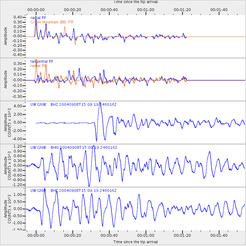
Signal To Noise
| Channel | StoN | STA | LTA |
| UW:GNW: :BHN:20040908T15:09:19.246016Z | 4.682903 | 304.6247 | 65.0504 |
| UW:GNW: :BHE:20040908T15:09:19.246016Z | 11.980481 | 590.90814 | 49.322575 |
| UW:GNW: :BHZ:20040908T15:09:19.246016Z | 30.41973 | 2019.7612 | 66.39642 |
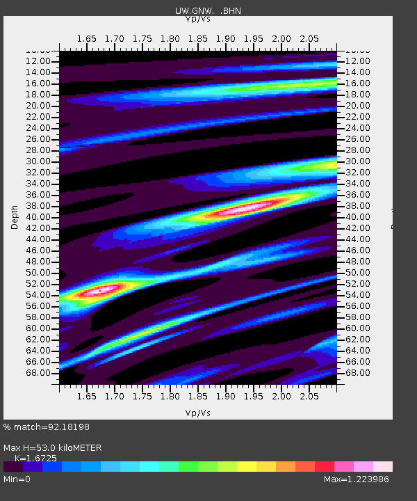
| Arrivals | |
| Ps | 5.6 SECOND |
| PpPs | 21 SECOND |
| PsPs/PpSs | 26 SECOND |

