You are here: Home > Network List > GT - Global Telemetered Seismograph Network (USAF/USGS) Stations List
> Station LPAZ La Paz , Bolivia > Earthquake Result Viewer
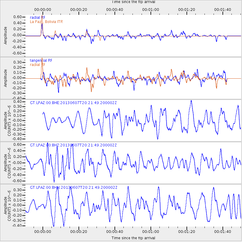
LPAZ La Paz , Bolivia - Earthquake Result Viewer
*The percent match for this event was below the threshold and hence no stack was calculated.
| Earthquake location: |
Southern Mid-Atlantic Ridge |
| Earthquake latitude/longitude: |
-43.8/-16.2 |
| Earthquake time(UTC): |
2013/06/07 (158) 20:13:13 GMT |
| Earthquake Depth: |
7.2 km |
| Earthquake Magnitude: |
5.7 MW, 5.5 MS, 5.6 MW, 5.8 MB |
| Earthquake Catalog/Contributor: |
NEIC PDE/NEIC PDE-W |
|
| Network: |
GT Global Telemetered Seismograph Network (USAF/USGS) |
| Station: |
LPAZ La Paz , Bolivia |
| Lat/Lon: |
16.17 S/68.08 W |
| Elevation: |
4817 m |
|
| Distance: |
51.7 deg |
| Az: |
285.384 deg |
| Baz: |
133.358 deg |
| Ray Param: |
$rayparam |
*The percent match for this event was below the threshold and hence was not used in the summary stack. |
|
| Radial Match: |
74.25963 % |
| Radial Bump: |
336 |
| Transverse Match: |
70.02737 % |
| Transverse Bump: |
400 |
| SOD ConfigId: |
512894 |
| Insert Time: |
2013-09-15 01:41:57.250 +0000 |
| GWidth: |
2.5 |
| Max Bumps: |
400 |
| Tol: |
0.001 |
|
Signal To Noise
| Channel | StoN | STA | LTA |
| GT:LPAZ:00:BHZ:20130607T20:21:49.200002Z | 1.8707547 | 2.8766857E-7 | 1.5377141E-7 |
| GT:LPAZ:00:BHN:20130607T20:21:49.200002Z | 1.041687 | 1.2509143E-7 | 1.2008543E-7 |
| GT:LPAZ:00:BHE:20130607T20:21:49.200002Z | 1.2409301 | 1.4284392E-7 | 1.1511037E-7 |
| Arrivals |
| Ps | |
| PpPs | |
| PsPs/PpSs | |


