You are here: Home > Network List > TA - USArray Transportable Network (new EarthScope stations) Stations List
> Station 356A Blackshear, GA, USA > Earthquake Result Viewer
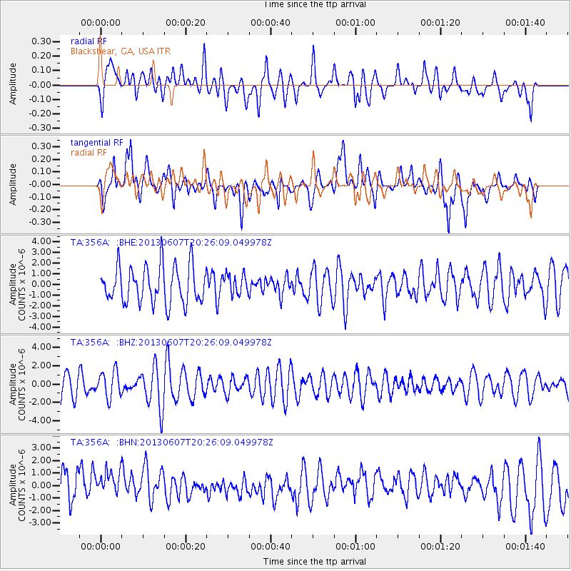
356A Blackshear, GA, USA - Earthquake Result Viewer
*The percent match for this event was below the threshold and hence no stack was calculated.
| Earthquake location: |
Southern Mid-Atlantic Ridge |
| Earthquake latitude/longitude: |
-43.8/-16.2 |
| Earthquake time(UTC): |
2013/06/07 (158) 20:13:13 GMT |
| Earthquake Depth: |
7.2 km |
| Earthquake Magnitude: |
5.7 MW, 5.5 MS, 5.6 MW, 5.8 MB |
| Earthquake Catalog/Contributor: |
NEIC PDE/NEIC PDE-W |
|
| Network: |
TA USArray Transportable Network (new EarthScope stations) |
| Station: |
356A Blackshear, GA, USA |
| Lat/Lon: |
31.32 N/82.13 W |
| Elevation: |
36 m |
|
| Distance: |
96.0 deg |
| Az: |
308.214 deg |
| Baz: |
138.295 deg |
| Ray Param: |
$rayparam |
*The percent match for this event was below the threshold and hence was not used in the summary stack. |
|
| Radial Match: |
48.856503 % |
| Radial Bump: |
400 |
| Transverse Match: |
54.065952 % |
| Transverse Bump: |
400 |
| SOD ConfigId: |
512894 |
| Insert Time: |
2013-09-15 01:47:21.761 +0000 |
| GWidth: |
2.5 |
| Max Bumps: |
400 |
| Tol: |
0.001 |
|
Signal To Noise
| Channel | StoN | STA | LTA |
| TA:356A: :BHZ:20130607T20:26:09.049978Z | 0.9828542 | 1.4998085E-6 | 1.5259725E-6 |
| TA:356A: :BHN:20130607T20:26:09.049978Z | 0.90409833 | 1.2023479E-6 | 1.3298861E-6 |
| TA:356A: :BHE:20130607T20:26:09.049978Z | 0.5349795 | 9.316341E-7 | 1.7414387E-6 |
| Arrivals |
| Ps | |
| PpPs | |
| PsPs/PpSs | |


