You are here: Home > Network List > TA - USArray Transportable Network (new EarthScope stations) Stations List
> Station V61A Roper, NC, USA > Earthquake Result Viewer
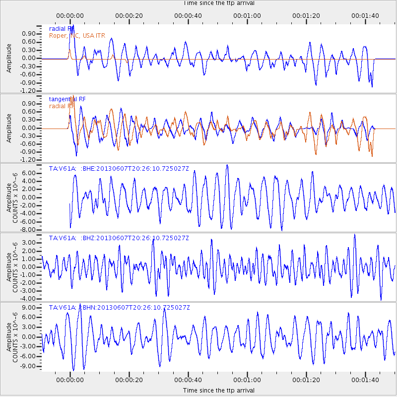
V61A Roper, NC, USA - Earthquake Result Viewer
*The percent match for this event was below the threshold and hence no stack was calculated.
| Earthquake location: |
Southern Mid-Atlantic Ridge |
| Earthquake latitude/longitude: |
-43.8/-16.2 |
| Earthquake time(UTC): |
2013/06/07 (158) 20:13:13 GMT |
| Earthquake Depth: |
7.2 km |
| Earthquake Magnitude: |
5.7 MW, 5.5 MS, 5.6 MW, 5.8 MB |
| Earthquake Catalog/Contributor: |
NEIC PDE/NEIC PDE-W |
|
| Network: |
TA USArray Transportable Network (new EarthScope stations) |
| Station: |
V61A Roper, NC, USA |
| Lat/Lon: |
35.79 N/76.58 W |
| Elevation: |
4.0 m |
|
| Distance: |
96.3 deg |
| Az: |
314.666 deg |
| Baz: |
140.662 deg |
| Ray Param: |
$rayparam |
*The percent match for this event was below the threshold and hence was not used in the summary stack. |
|
| Radial Match: |
58.974144 % |
| Radial Bump: |
400 |
| Transverse Match: |
65.521965 % |
| Transverse Bump: |
400 |
| SOD ConfigId: |
512894 |
| Insert Time: |
2013-09-15 01:49:00.358 +0000 |
| GWidth: |
2.5 |
| Max Bumps: |
400 |
| Tol: |
0.001 |
|
Signal To Noise
| Channel | StoN | STA | LTA |
| TA:V61A: :BHZ:20130607T20:26:10.725027Z | 0.90446067 | 1.245266E-6 | 1.376805E-6 |
| TA:V61A: :BHN:20130607T20:26:10.725027Z | 2.1058729 | 6.835339E-6 | 3.2458458E-6 |
| TA:V61A: :BHE:20130607T20:26:10.725027Z | 0.9066694 | 2.6441035E-6 | 2.9162818E-6 |
| Arrivals |
| Ps | |
| PpPs | |
| PsPs/PpSs | |


