You are here: Home > Network List > TA - USArray Transportable Network (new EarthScope stations) Stations List
> Station 151A Opelika, AL, USA > Earthquake Result Viewer
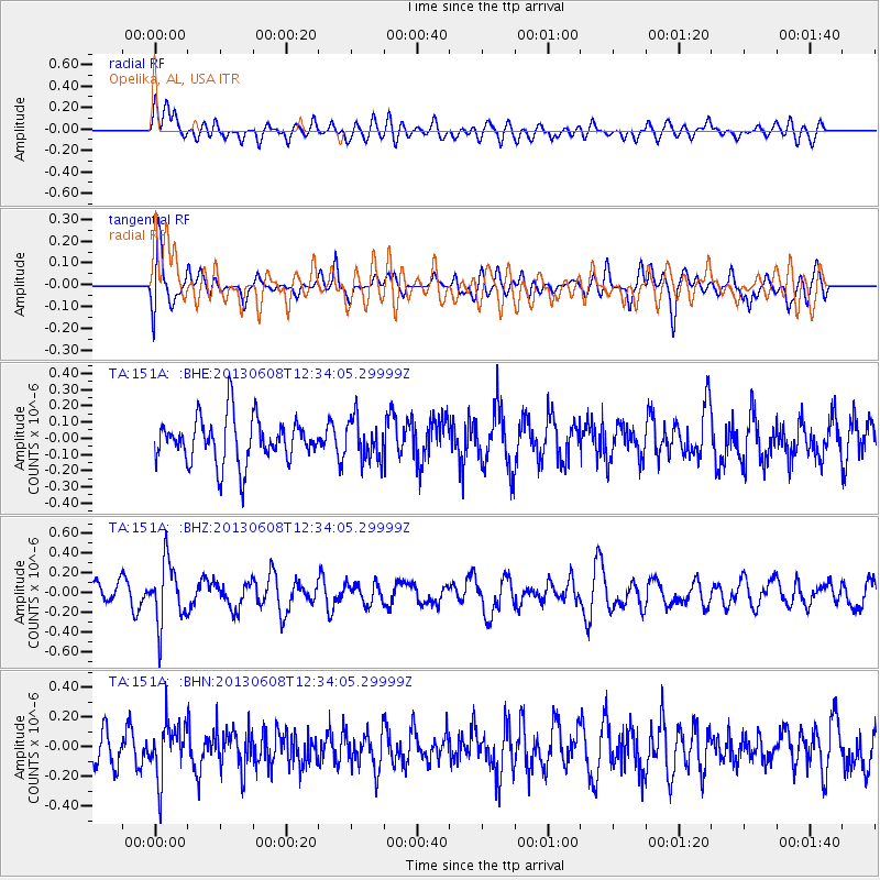
151A Opelika, AL, USA - Earthquake Result Viewer
*The percent match for this event was below the threshold and hence no stack was calculated.
| Earthquake location: |
Jujuy Province, Argentina |
| Earthquake latitude/longitude: |
-22.6/-66.7 |
| Earthquake time(UTC): |
2013/06/08 (159) 12:25:08 GMT |
| Earthquake Depth: |
215 km |
| Earthquake Magnitude: |
5.6 MW, 5.5 MB, 5.6 MW |
| Earthquake Catalog/Contributor: |
NEIC PDE/NEIC PDE-W |
|
| Network: |
TA USArray Transportable Network (new EarthScope stations) |
| Station: |
151A Opelika, AL, USA |
| Lat/Lon: |
32.53 N/85.33 W |
| Elevation: |
211 m |
|
| Distance: |
57.6 deg |
| Az: |
341.36 deg |
| Baz: |
159.533 deg |
| Ray Param: |
$rayparam |
*The percent match for this event was below the threshold and hence was not used in the summary stack. |
|
| Radial Match: |
52.23888 % |
| Radial Bump: |
400 |
| Transverse Match: |
63.526276 % |
| Transverse Bump: |
400 |
| SOD ConfigId: |
512894 |
| Insert Time: |
2013-09-15 02:24:41.952 +0000 |
| GWidth: |
2.5 |
| Max Bumps: |
400 |
| Tol: |
0.001 |
|
Signal To Noise
| Channel | StoN | STA | LTA |
| TA:151A: :BHZ:20130608T12:34:05.29999Z | 1.9999171 | 3.094386E-7 | 1.547257E-7 |
| TA:151A: :BHN:20130608T12:34:05.29999Z | 1.7465698 | 1.8393327E-7 | 1.05311145E-7 |
| TA:151A: :BHE:20130608T12:34:05.29999Z | 0.88885593 | 1.2337794E-7 | 1.3880533E-7 |
| Arrivals |
| Ps | |
| PpPs | |
| PsPs/PpSs | |


