You are here: Home > Network List > UW - Pacific Northwest Regional Seismic Network Stations List
> Station GNW Green Mountain (BB) > Earthquake Result Viewer
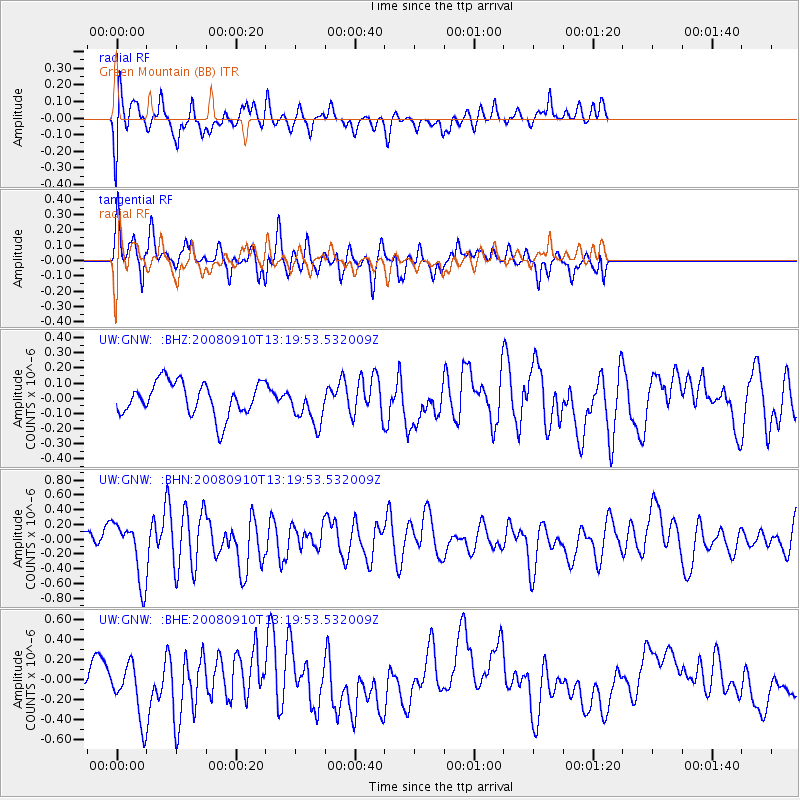
GNW Green Mountain (BB) - Earthquake Result Viewer
*The percent match for this event was below the threshold and hence no stack was calculated.
| Earthquake location: |
Central Mid-Atlantic Ridge |
| Earthquake latitude/longitude: |
8.1/-38.7 |
| Earthquake time(UTC): |
2008/09/10 (254) 13:08:14 GMT |
| Earthquake Depth: |
10 km |
| Earthquake Magnitude: |
6.3 MB, 6.5 MS, 6.6 MW, 6.6 MW |
| Earthquake Catalog/Contributor: |
WHDF/NEIC |
|
| Network: |
UW Pacific Northwest Regional Seismic Network |
| Station: |
GNW Green Mountain (BB) |
| Lat/Lon: |
47.56 N/122.83 W |
| Elevation: |
160 m |
|
| Distance: |
80.1 deg |
| Az: |
316.858 deg |
| Baz: |
88.842 deg |
| Ray Param: |
$rayparam |
*The percent match for this event was below the threshold and hence was not used in the summary stack. |
|
| Radial Match: |
59.14575 % |
| Radial Bump: |
400 |
| Transverse Match: |
57.31387 % |
| Transverse Bump: |
347 |
| SOD ConfigId: |
2560 |
| Insert Time: |
2010-02-27 04:21:37.658 +0000 |
| GWidth: |
2.5 |
| Max Bumps: |
400 |
| Tol: |
0.001 |
|
Signal To Noise
| Channel | StoN | STA | LTA |
| UW:GNW: :BHN:20080910T13:19:53.532009Z | 4.662004 | 3.9188816E-7 | 8.406002E-8 |
| UW:GNW: :BHE:20080910T13:19:53.532009Z | 1.8672972 | 2.7502608E-7 | 1.4728566E-7 |
| UW:GNW: :BHZ:20080910T13:19:53.532009Z | 1.1787529 | 1.2917604E-7 | 1.0958705E-7 |
| Arrivals |
| Ps | |
| PpPs | |
| PsPs/PpSs | |


