You are here: Home > Network List > TA - USArray Transportable Network (new EarthScope stations) Stations List
> Station V46A Holladay, TN, USA > Earthquake Result Viewer
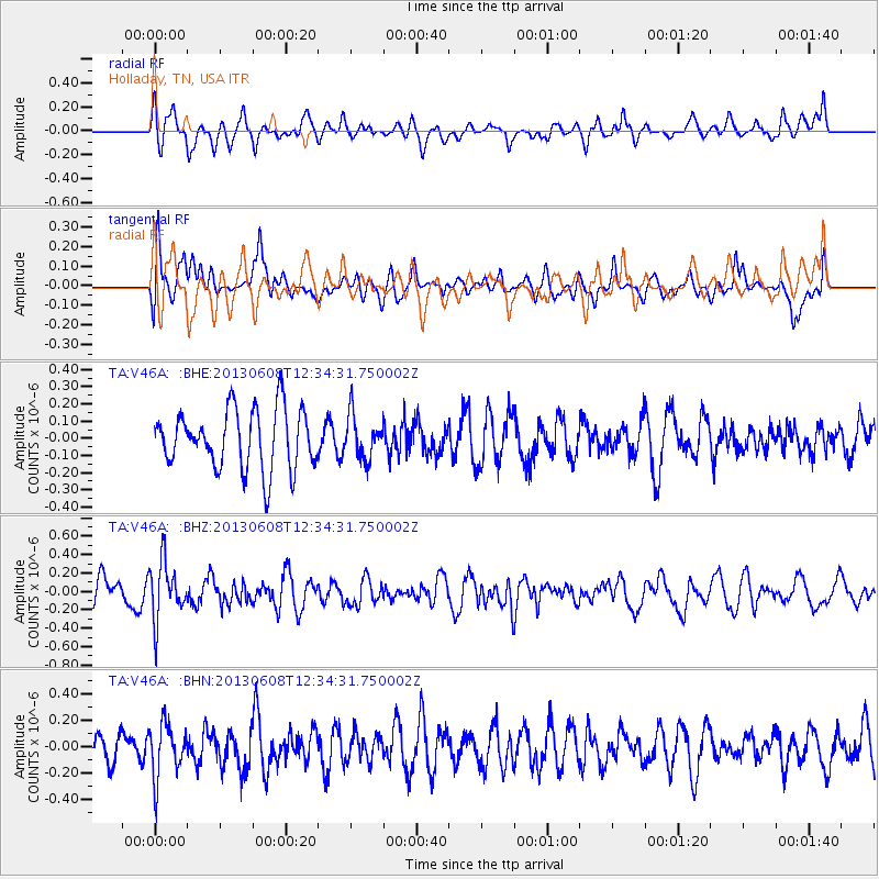
V46A Holladay, TN, USA - Earthquake Result Viewer
*The percent match for this event was below the threshold and hence no stack was calculated.
| Earthquake location: |
Jujuy Province, Argentina |
| Earthquake latitude/longitude: |
-22.6/-66.7 |
| Earthquake time(UTC): |
2013/06/08 (159) 12:25:08 GMT |
| Earthquake Depth: |
215 km |
| Earthquake Magnitude: |
5.6 MW, 5.5 MB, 5.6 MW |
| Earthquake Catalog/Contributor: |
NEIC PDE/NEIC PDE-W |
|
| Network: |
TA USArray Transportable Network (new EarthScope stations) |
| Station: |
V46A Holladay, TN, USA |
| Lat/Lon: |
35.80 N/88.12 W |
| Elevation: |
162 m |
|
| Distance: |
61.5 deg |
| Az: |
340.253 deg |
| Baz: |
157.41 deg |
| Ray Param: |
$rayparam |
*The percent match for this event was below the threshold and hence was not used in the summary stack. |
|
| Radial Match: |
71.33054 % |
| Radial Bump: |
400 |
| Transverse Match: |
64.66018 % |
| Transverse Bump: |
400 |
| SOD ConfigId: |
512894 |
| Insert Time: |
2013-09-15 02:37:26.104 +0000 |
| GWidth: |
2.5 |
| Max Bumps: |
400 |
| Tol: |
0.001 |
|
Signal To Noise
| Channel | StoN | STA | LTA |
| TA:V46A: :BHZ:20130608T12:34:31.750002Z | 1.8792979 | 3.111742E-7 | 1.6558003E-7 |
| TA:V46A: :BHN:20130608T12:34:31.750002Z | 1.8705009 | 2.0359161E-7 | 1.0884336E-7 |
| TA:V46A: :BHE:20130608T12:34:31.750002Z | 0.7249077 | 1.2505613E-7 | 1.7251318E-7 |
| Arrivals |
| Ps | |
| PpPs | |
| PsPs/PpSs | |


