
HEBO Mt. Hebo, OR CREST BB SMO - Earthquake Result Viewer
| ||||||||||||||||||
| ||||||||||||||||||
| ||||||||||||||||||
|
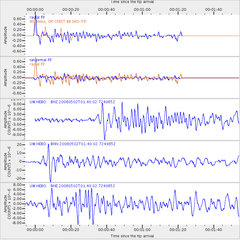
Signal To Noise
| Channel | StoN | STA | LTA |
| UW:HEBO: :BHN:20080502T01:40:02.724985Z | 5.244036 | 2.4164065E-6 | 4.607913E-7 |
| UW:HEBO: :BHE:20080502T01:40:02.724985Z | 1.5522554 | 6.7256747E-7 | 4.3328404E-7 |
| UW:HEBO: :BHZ:20080502T01:40:02.724985Z | 1.4598724 | 8.145827E-7 | 5.579821E-7 |
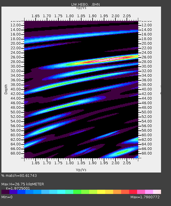
| Arrivals | |
| Ps | 4.3 SECOND |
| PpPs | 11 SECOND |
| PsPs/PpSs | 16 SECOND |

