You are here: Home > Network List > UW - Pacific Northwest Regional Seismic Network Stations List
> Station HEBO Mt. Hebo, OR CREST BB SMO > Earthquake Result Viewer
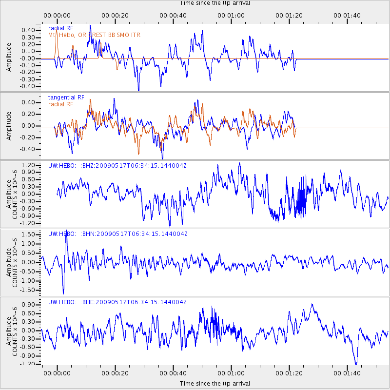
HEBO Mt. Hebo, OR CREST BB SMO - Earthquake Result Viewer
*The percent match for this event was below the threshold and hence no stack was calculated.
| Earthquake location: |
Tonga Islands |
| Earthquake latitude/longitude: |
-16.8/-173.5 |
| Earthquake time(UTC): |
2009/05/17 (137) 06:23:03 GMT |
| Earthquake Depth: |
67 km |
| Earthquake Magnitude: |
5.5 MB, 5.6 MW, 5.6 MW |
| Earthquake Catalog/Contributor: |
WHDF/NEIC |
|
| Network: |
UW Pacific Northwest Regional Seismic Network |
| Station: |
HEBO Mt. Hebo, OR CREST BB SMO |
| Lat/Lon: |
45.21 N/123.76 W |
| Elevation: |
875 m |
|
| Distance: |
76.5 deg |
| Az: |
33.696 deg |
| Baz: |
228.737 deg |
| Ray Param: |
$rayparam |
*The percent match for this event was below the threshold and hence was not used in the summary stack. |
|
| Radial Match: |
56.624123 % |
| Radial Bump: |
293 |
| Transverse Match: |
77.677216 % |
| Transverse Bump: |
270 |
| SOD ConfigId: |
2760 |
| Insert Time: |
2010-02-27 04:22:57.537 +0000 |
| GWidth: |
2.5 |
| Max Bumps: |
400 |
| Tol: |
0.001 |
|
Signal To Noise
| Channel | StoN | STA | LTA |
| UW:HEBO: :BHN:20090517T06:34:15.144004Z | 3.9323478 | 7.4551747E-7 | 1.8958585E-7 |
| UW:HEBO: :BHE:20090517T06:34:15.144004Z | 1.0848396 | 2.9258663E-7 | 2.6970497E-7 |
| UW:HEBO: :BHZ:20090517T06:34:15.144004Z | 3.125927 | 7.3356983E-7 | 2.3467273E-7 |
| Arrivals |
| Ps | |
| PpPs | |
| PsPs/PpSs | |


