You are here: Home > Network List > US - United States National Seismic Network Stations List
> Station MSO Missoula, Montana, USA > Earthquake Result Viewer
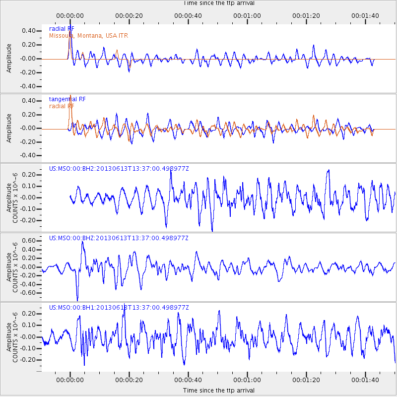
MSO Missoula, Montana, USA - Earthquake Result Viewer
*The percent match for this event was below the threshold and hence no stack was calculated.
| Earthquake location: |
Ryukyu Islands, Japan |
| Earthquake latitude/longitude: |
26.5/128.9 |
| Earthquake time(UTC): |
2013/06/13 (164) 13:24:45 GMT |
| Earthquake Depth: |
20 km |
| Earthquake Magnitude: |
5.6 MW, 5.6 MW, 5.9 MB |
| Earthquake Catalog/Contributor: |
NEIC PDE/NEIC PDE-W |
|
| Network: |
US United States National Seismic Network |
| Station: |
MSO Missoula, Montana, USA |
| Lat/Lon: |
46.83 N/113.94 W |
| Elevation: |
1264 m |
|
| Distance: |
87.6 deg |
| Az: |
37.689 deg |
| Baz: |
307.089 deg |
| Ray Param: |
$rayparam |
*The percent match for this event was below the threshold and hence was not used in the summary stack. |
|
| Radial Match: |
71.54391 % |
| Radial Bump: |
400 |
| Transverse Match: |
74.14403 % |
| Transverse Bump: |
400 |
| SOD ConfigId: |
512894 |
| Insert Time: |
2013-09-15 03:15:04.051 +0000 |
| GWidth: |
2.5 |
| Max Bumps: |
400 |
| Tol: |
0.001 |
|
Signal To Noise
| Channel | StoN | STA | LTA |
| US:MSO:00:BHZ:20130613T13:37:00.498977Z | 3.1354663 | 3.1954585E-7 | 1.0191334E-7 |
| US:MSO:00:BH1:20130613T13:37:00.498977Z | 2.8880544 | 1.0562121E-7 | 3.6571752E-8 |
| US:MSO:00:BH2:20130613T13:37:00.498977Z | 2.1922016 | 1.1538358E-7 | 5.263365E-8 |
| Arrivals |
| Ps | |
| PpPs | |
| PsPs/PpSs | |


