You are here: Home > Network List > UU - University of Utah Regional Network Stations List
> Station KNB Kanab, UT, USA > Earthquake Result Viewer
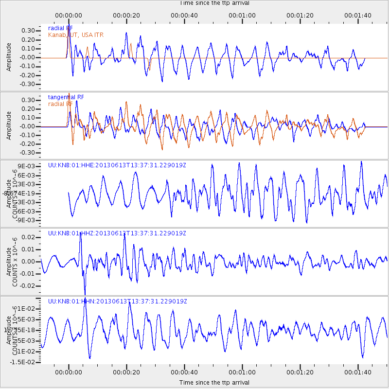
KNB Kanab, UT, USA - Earthquake Result Viewer
*The percent match for this event was below the threshold and hence no stack was calculated.
| Earthquake location: |
Ryukyu Islands, Japan |
| Earthquake latitude/longitude: |
26.5/128.9 |
| Earthquake time(UTC): |
2013/06/13 (164) 13:24:45 GMT |
| Earthquake Depth: |
20 km |
| Earthquake Magnitude: |
5.6 MW, 5.6 MW, 5.9 MB |
| Earthquake Catalog/Contributor: |
NEIC PDE/NEIC PDE-W |
|
| Network: |
UU University of Utah Regional Network |
| Station: |
KNB Kanab, UT, USA |
| Lat/Lon: |
37.02 N/112.82 W |
| Elevation: |
1715 m |
|
| Distance: |
94.2 deg |
| Az: |
44.967 deg |
| Baz: |
307.722 deg |
| Ray Param: |
$rayparam |
*The percent match for this event was below the threshold and hence was not used in the summary stack. |
|
| Radial Match: |
66.72572 % |
| Radial Bump: |
400 |
| Transverse Match: |
54.661793 % |
| Transverse Bump: |
400 |
| SOD ConfigId: |
512894 |
| Insert Time: |
2013-09-15 03:15:54.383 +0000 |
| GWidth: |
2.5 |
| Max Bumps: |
400 |
| Tol: |
0.001 |
|
Signal To Noise
| Channel | StoN | STA | LTA |
| UU:KNB:01:HHZ:20130613T13:37:31.229019Z | 2.457598 | 7.894306E-9 | 3.2122036E-9 |
| UU:KNB:01:HHN:20130613T13:37:31.229019Z | 0.82630277 | 3.1911915E-9 | 3.8620125E-9 |
| UU:KNB:01:HHE:20130613T13:37:31.229019Z | 0.6340959 | 2.1136515E-9 | 3.333331E-9 |
| Arrivals |
| Ps | |
| PpPs | |
| PsPs/PpSs | |


