You are here: Home > Network List > IC - New China Digital Seismograph Network Stations List
> Station KMI Kunming, Yunnan Province, China > Earthquake Result Viewer
KMI Kunming, Yunnan Province, China - Earthquake Result Viewer

| Earthquake location: |
South Of Java, Indonesia |
| Earthquake latitude/longitude: |
-10.0/107.2 |
| Earthquake time(UTC): |
2013/06/13 (164) 16:47:23 GMT |
| Earthquake Depth: |
9.0 km |
| Earthquake Magnitude: |
6.7 MW, 6.4 MS, 6.5 MB, 6.7 MW |
| Earthquake Catalog/Contributor: |
NEIC PDE/NEIC PDE-W |
|
| Network: |
IC New China Digital Seismograph Network |
| Station: |
KMI Kunming, Yunnan Province, China |
| Lat/Lon: |
25.12 N/102.74 E |
| Elevation: |
1975 m |
|
| Distance: |
35.2 deg |
| Az: |
352.917 deg |
| Baz: |
172.3 deg |
| Ray Param: |
0.07735616 |
| Estimated Moho Depth: |
34.75 km |
| Estimated Crust Vp/Vs: |
2.00 |
| Assumed Crust Vp: |
6.247 km/s |
| Estimated Crust Vs: |
3.127 km/s |
| Estimated Crust Poisson's Ratio: |
0.33 |
|
| Radial Match: |
95.47532 % |
| Radial Bump: |
397 |
| Transverse Match: |
87.601654 % |
| Transverse Bump: |
400 |
| SOD ConfigId: |
512894 |
| Insert Time: |
2013-09-15 03:23:30.323 +0000 |
| GWidth: |
2.5 |
| Max Bumps: |
400 |
| Tol: |
0.001 |
|
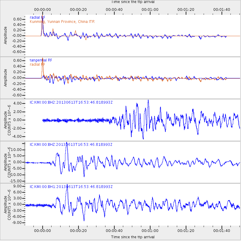
Signal To Noise
| Channel | StoN | STA | LTA |
| IC:KMI:00:BHZ:20130613T16:53:46.818993Z | 3.019391 | 4.3306244E-7 | 1.4342707E-7 |
| IC:KMI:00:BH1:20130613T16:53:46.818993Z | 1.535646 | 4.057585E-7 | 2.642266E-7 |
| IC:KMI:00:BH2:20130613T16:53:46.818993Z | 1.3791084 | 2.6819143E-7 | 1.9446725E-7 |
| Arrivals |
| Ps | 5.9 SECOND |
| PpPs | 16 SECOND |
| PsPs/PpSs | 22 SECOND |


