HOOD Mt Hood Meadows, OR CREST BB SMO - Earthquake Result Viewer
Earthquake location: Andreanof Islands, Aleutian Is.
Earthquake latitude/longitude: 51.2/-179.3
Earthquake time(UTC): 2006/07/08 (189) 20:40:00 GMT
Earthquake Depth: 22 km
Earthquake Magnitude: 6.2 MB, 6.4 MS, 6.6 MW, 6.6 MW
Earthquake Catalog/Contributor: WHDF/NEIC
Network: UW Pacific Northwest Regional Seismic Network
Station: HOOD Mt Hood Meadows, OR CREST BB SMO
Lat/Lon: 45.32 N/121.65 W
Elevation: 1520 m
Distance: 38.0 deg
Az: 75.665 deg
Baz: 300.26 deg
Ray Param: 0.075801745
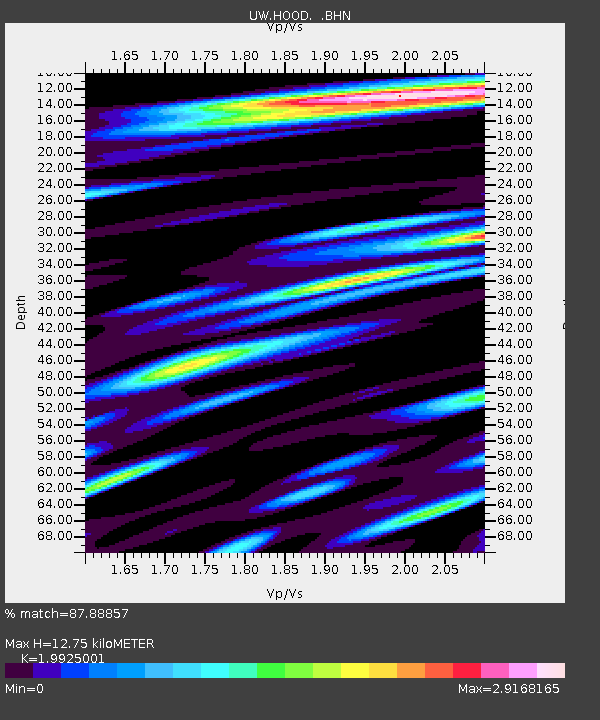
Estimated Moho Depth: 12.75 km
Estimated Crust Vp/Vs: 1.99
Assumed Crust Vp: 6.597 km/s
Estimated Crust Vs: 3.311 km/s
Estimated Crust Poisson's Ratio: 0.33
Radial Match: 87.88857 %
Radial Bump: 400
Transverse Match: 75.404335 %
Transverse Bump: 400
SOD ConfigId: 2665
Insert Time: 2010-02-27 04:24:02.089 +0000
GWidth: 2.5
Max Bumps: 400
Tol: 0.001

Signal To Noise

ChannelStoNSTALTA
UW:HOOD: :BHN:20060708T20:46:46.305012Z1.77302912.7978453E-71.578003E-7
UW:HOOD: :BHE:20060708T20:46:46.305012Z2.26451163.493251E-71.5426066E-7
UW:HOOD: :BHZ:20060708T20:46:46.305012Z3.7159637.675333E-72.0655033E-7
Arrivals
Ps2.1 SECOND
PpPs5.4 SECOND
PsPs/PpSs7.5 SECOND