You are here: Home > Network List > IU - Global Seismograph Network (GSN - IRIS/USGS) Stations List
> Station PMG Port Moresby, New Guinea > Earthquake Result Viewer
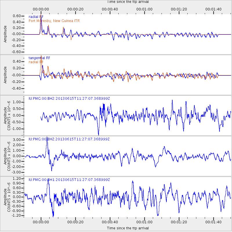
PMG Port Moresby, New Guinea - Earthquake Result Viewer
*The percent match for this event was below the threshold and hence no stack was calculated.
| Earthquake location: |
South Of Kermadec Islands |
| Earthquake latitude/longitude: |
-33.9/179.4 |
| Earthquake time(UTC): |
2013/06/15 (166) 11:20:36 GMT |
| Earthquake Depth: |
195 km |
| Earthquake Magnitude: |
6.0 MW, 5.5 MB, 6.0 MW |
| Earthquake Catalog/Contributor: |
NEIC PDE/NEIC PDE-W |
|
| Network: |
IU Global Seismograph Network (GSN - IRIS/USGS) |
| Station: |
PMG Port Moresby, New Guinea |
| Lat/Lon: |
9.40 S/147.16 E |
| Elevation: |
90 m |
|
| Distance: |
38.3 deg |
| Az: |
301.899 deg |
| Baz: |
134.274 deg |
| Ray Param: |
$rayparam |
*The percent match for this event was below the threshold and hence was not used in the summary stack. |
|
| Radial Match: |
82.62838 % |
| Radial Bump: |
400 |
| Transverse Match: |
67.725174 % |
| Transverse Bump: |
400 |
| SOD ConfigId: |
512894 |
| Insert Time: |
2013-09-15 03:38:59.511 +0000 |
| GWidth: |
2.5 |
| Max Bumps: |
400 |
| Tol: |
0.001 |
|
Signal To Noise
| Channel | StoN | STA | LTA |
| IU:PMG:00:BHZ:20130615T11:27:07.368999Z | 9.5144415 | 1.2125214E-6 | 1.274401E-7 |
| IU:PMG:00:BH1:20130615T11:27:07.368999Z | 2.4990802 | 4.6624402E-7 | 1.8656625E-7 |
| IU:PMG:00:BH2:20130615T11:27:07.368999Z | 2.5157845 | 5.136594E-7 | 2.0417464E-7 |
| Arrivals |
| Ps | |
| PpPs | |
| PsPs/PpSs | |


