You are here: Home > Network List > TA - USArray Transportable Network (new EarthScope stations) Stations List
> Station J04D Umpqua National Forest, Toketee, OR, USA > Earthquake Result Viewer
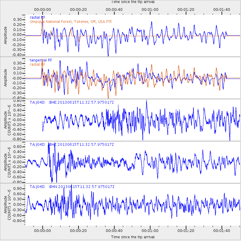
J04D Umpqua National Forest, Toketee, OR, USA - Earthquake Result Viewer
*The percent match for this event was below the threshold and hence no stack was calculated.
| Earthquake location: |
South Of Kermadec Islands |
| Earthquake latitude/longitude: |
-33.9/179.4 |
| Earthquake time(UTC): |
2013/06/15 (166) 11:20:36 GMT |
| Earthquake Depth: |
195 km |
| Earthquake Magnitude: |
6.0 MW, 5.5 MB, 6.0 MW |
| Earthquake Catalog/Contributor: |
NEIC PDE/NEIC PDE-W |
|
| Network: |
TA USArray Transportable Network (new EarthScope stations) |
| Station: |
J04D Umpqua National Forest, Toketee, OR, USA |
| Lat/Lon: |
43.24 N/122.11 W |
| Elevation: |
1948 m |
|
| Distance: |
93.5 deg |
| Az: |
38.621 deg |
| Baz: |
225.299 deg |
| Ray Param: |
$rayparam |
*The percent match for this event was below the threshold and hence was not used in the summary stack. |
|
| Radial Match: |
54.861748 % |
| Radial Bump: |
400 |
| Transverse Match: |
52.972233 % |
| Transverse Bump: |
400 |
| SOD ConfigId: |
512894 |
| Insert Time: |
2013-09-15 03:42:22.269 +0000 |
| GWidth: |
2.5 |
| Max Bumps: |
400 |
| Tol: |
0.001 |
|
Signal To Noise
| Channel | StoN | STA | LTA |
| TA:J04D: :BHZ:20130615T11:32:57.975017Z | 2.2458732 | 2.7760672E-7 | 1.2360748E-7 |
| TA:J04D: :BHN:20130615T11:32:57.975017Z | 0.9227716 | 1.9664064E-7 | 2.1309785E-7 |
| TA:J04D: :BHE:20130615T11:32:57.975017Z | 1.1208452 | 1.893955E-7 | 1.689756E-7 |
| Arrivals |
| Ps | |
| PpPs | |
| PsPs/PpSs | |


