You are here: Home > Network List > UW - Pacific Northwest Regional Seismic Network Stations List
> Station MRBL Marblemount, WA, USA > Earthquake Result Viewer
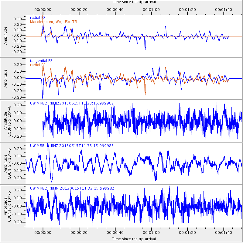
MRBL Marblemount, WA, USA - Earthquake Result Viewer
*The percent match for this event was below the threshold and hence no stack was calculated.
| Earthquake location: |
South Of Kermadec Islands |
| Earthquake latitude/longitude: |
-33.9/179.4 |
| Earthquake time(UTC): |
2013/06/15 (166) 11:20:36 GMT |
| Earthquake Depth: |
195 km |
| Earthquake Magnitude: |
6.0 MW, 5.5 MB, 6.0 MW |
| Earthquake Catalog/Contributor: |
NEIC PDE/NEIC PDE-W |
|
| Network: |
UW Pacific Northwest Regional Seismic Network |
| Station: |
MRBL Marblemount, WA, USA |
| Lat/Lon: |
48.52 N/121.48 W |
| Elevation: |
75 m |
|
| Distance: |
97.5 deg |
| Az: |
35.133 deg |
| Baz: |
226.08 deg |
| Ray Param: |
$rayparam |
*The percent match for this event was below the threshold and hence was not used in the summary stack. |
|
| Radial Match: |
55.248634 % |
| Radial Bump: |
353 |
| Transverse Match: |
67.24994 % |
| Transverse Bump: |
333 |
| SOD ConfigId: |
512894 |
| Insert Time: |
2013-09-15 03:44:43.500 +0000 |
| GWidth: |
2.5 |
| Max Bumps: |
400 |
| Tol: |
0.001 |
|
Signal To Noise
| Channel | StoN | STA | LTA |
| UW:MRBL: :BHZ:20130615T11:33:15.99998Z | 2.8895316 | 1.4879075E-7 | 5.1493032E-8 |
| UW:MRBL: :BHN:20130615T11:33:15.99998Z | 1.4971288 | 9.06593E-8 | 6.0555436E-8 |
| UW:MRBL: :BHE:20130615T11:33:15.99998Z | 0.8253975 | 6.875796E-8 | 8.3302844E-8 |
| Arrivals |
| Ps | |
| PpPs | |
| PsPs/PpSs | |


