HOOD Mt Hood Meadows, OR CREST BB SMO - Earthquake Result Viewer
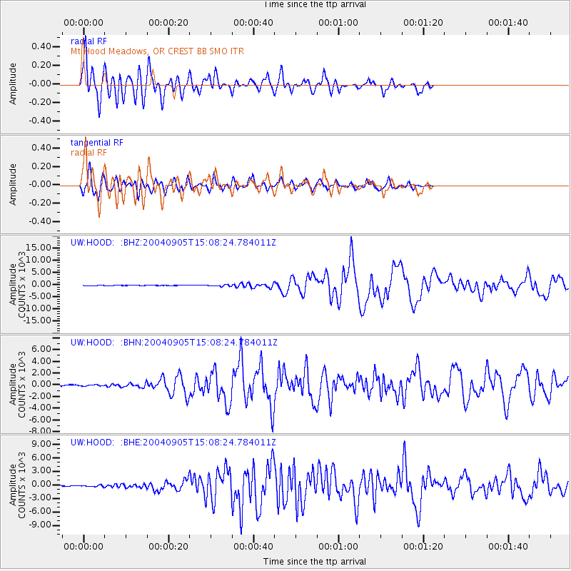
Earthquake location: Near S. Coast Of Honshu, Japan
Earthquake latitude/longitude: 33.2/137.1
Earthquake time(UTC): 2004/09/05 (249) 14:57:18 GMT
Earthquake Depth: 10 km
Earthquake Magnitude: 6.2 MB, 7.1 MS, 7.4 MW, 7.4 MW
Earthquake Catalog/Contributor: WHDF/NEIC
Network: UW Pacific Northwest Regional Seismic Network
Station: HOOD Mt Hood Meadows, OR CREST BB SMO
Lat/Lon: 45.32 N/121.65 W
Elevation: 1520 m
Distance: 74.3 deg
Az: 45.944 deg
Baz: 301.326 deg
Ray Param: 0.052417614
Estimated Moho Depth: 29.5 km
Estimated Crust Vp/Vs: 2.10
Assumed Crust Vp: 6.597 km/s
Estimated Crust Vs: 3.145 km/s
Estimated Crust Poisson's Ratio: 0.35
Radial Match: 90.484276 %
Radial Bump: 400
Transverse Match: 86.54771 %
Transverse Bump: 400
SOD ConfigId: 2459
Insert Time: 2010-02-27 04:24:38.754 +0000
GWidth: 2.5
Max Bumps: 400
Tol: 0.001

Signal To Noise

ChannelStoNSTALTA
UW:HOOD: :BHN:20040905T15:08:24.784011Z1.2512879108.3944286.626274
UW:HOOD: :BHE:20040905T15:08:24.784011Z1.7696661147.2380783.20104
UW:HOOD: :BHZ:20040905T15:08:24.784011Z3.964174301.9013776.15744
Arrivals
Ps5.1 SECOND
PpPs13 SECOND
PsPs/PpSs19 SECOND