You are here: Home > Network List > UW - Pacific Northwest Regional Seismic Network Stations List
> Station HOOD Mt Hood Meadows, OR CREST BB SMO > Earthquake Result Viewer
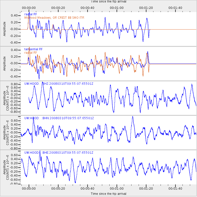
HOOD Mt Hood Meadows, OR CREST BB SMO - Earthquake Result Viewer
*The percent match for this event was below the threshold and hence no stack was calculated.
| Earthquake location: |
Chile-Argentina Border Region |
| Earthquake latitude/longitude: |
-28.3/-69.3 |
| Earthquake time(UTC): |
2008/03/10 (070) 09:43:01 GMT |
| Earthquake Depth: |
90 km |
| Earthquake Magnitude: |
5.6 MB, 5.6 MW |
| Earthquake Catalog/Contributor: |
WHDF/NEIC |
|
| Network: |
UW Pacific Northwest Regional Seismic Network |
| Station: |
HOOD Mt Hood Meadows, OR CREST BB SMO |
| Lat/Lon: |
45.32 N/121.65 W |
| Elevation: |
1520 m |
|
| Distance: |
87.4 deg |
| Az: |
325.997 deg |
| Baz: |
135.675 deg |
| Ray Param: |
$rayparam |
*The percent match for this event was below the threshold and hence was not used in the summary stack. |
|
| Radial Match: |
70.415726 % |
| Radial Bump: |
400 |
| Transverse Match: |
36.837364 % |
| Transverse Bump: |
294 |
| SOD ConfigId: |
2504 |
| Insert Time: |
2010-02-27 04:25:05.183 +0000 |
| GWidth: |
2.5 |
| Max Bumps: |
400 |
| Tol: |
0.001 |
|
Signal To Noise
| Channel | StoN | STA | LTA |
| UW:HOOD: :BHN:20080310T09:55:07.65501Z | 1.8387107 | 3.2450748E-7 | 1.7648642E-7 |
| UW:HOOD: :BHE:20080310T09:55:07.65501Z | 1.9294704 | 3.6138047E-7 | 1.8729516E-7 |
| UW:HOOD: :BHZ:20080310T09:55:07.65501Z | 0.40561453 | 1.6531001E-7 | 4.0755447E-7 |
| Arrivals |
| Ps | |
| PpPs | |
| PsPs/PpSs | |


