You are here: Home > Network List > UW - Pacific Northwest Regional Seismic Network Stations List
> Station HOOD Mt Hood Meadows, OR CREST BB SMO > Earthquake Result Viewer
HOOD Mt Hood Meadows, OR CREST BB SMO - Earthquake Result Viewer
*The percent match for this event was below the threshold and hence no stack was calculated.
| Earthquake location: |
Samoa Islands Region |
| Earthquake latitude/longitude: |
-15.6/-172.0 |
| Earthquake time(UTC): |
2009/09/29 (272) 18:08:21 GMT |
| Earthquake Depth: |
10 km |
| Earthquake Magnitude: |
5.6 MB |
| Earthquake Catalog/Contributor: |
WHDF/NEIC |
|
| Network: |
UW Pacific Northwest Regional Seismic Network |
| Station: |
HOOD Mt Hood Meadows, OR CREST BB SMO |
| Lat/Lon: |
45.32 N/121.65 W |
| Elevation: |
1520 m |
|
| Distance: |
75.8 deg |
| Az: |
34.081 deg |
| Baz: |
229.955 deg |
| Ray Param: |
$rayparam |
*The percent match for this event was below the threshold and hence was not used in the summary stack. |
|
| Radial Match: |
50.98375 % |
| Radial Bump: |
270 |
| Transverse Match: |
71.239685 % |
| Transverse Bump: |
258 |
| SOD ConfigId: |
2622 |
| Insert Time: |
2010-02-27 04:25:14.846 +0000 |
| GWidth: |
2.5 |
| Max Bumps: |
400 |
| Tol: |
0.001 |
|
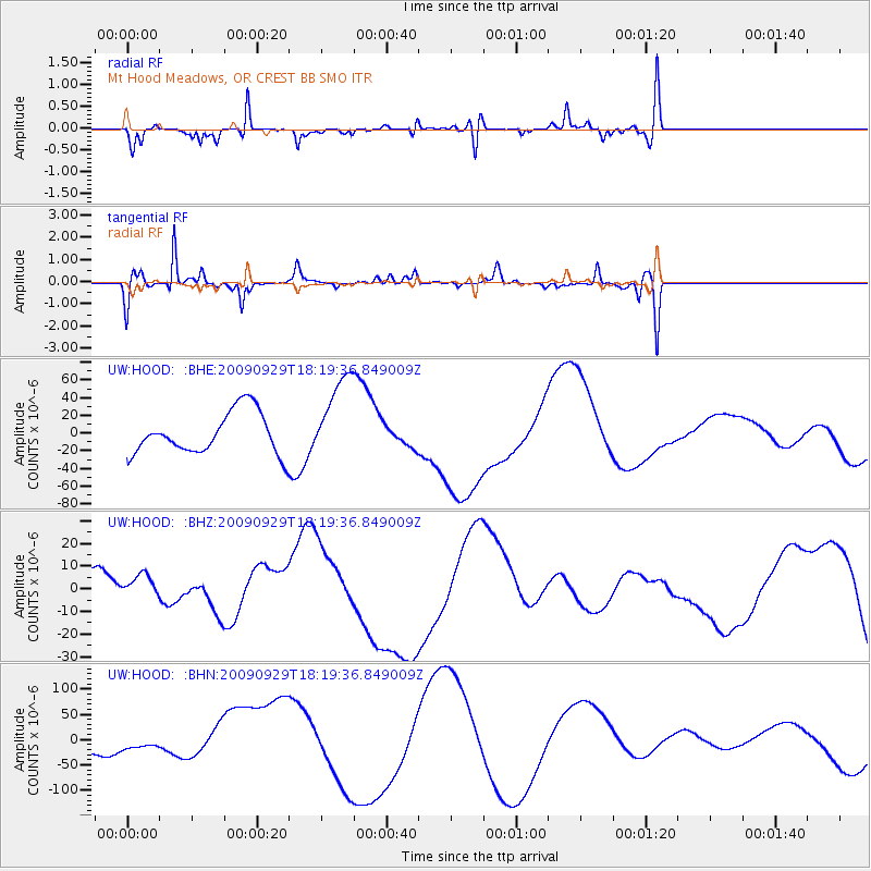
Signal To Noise
| Channel | StoN | STA | LTA |
| UW:HOOD: :BHZ:20090929T18:19:36.849009Z | 0.8500057 | 6.6339067E-6 | 7.804544E-6 |
| UW:HOOD: :BHN:20090929T18:19:36.849009Z | 0.88605374 | 1.1385178E-5 | 1.2849309E-5 |
| UW:HOOD: :BHE:20090929T18:19:36.849009Z | 2.0611367 | 4.824062E-5 | 2.3404862E-5 |
| Arrivals |
| Ps | |
| PpPs | |
| PsPs/PpSs | |


