You are here: Home > Network List > UW - Pacific Northwest Regional Seismic Network Stations List
> Station HOOD Mt Hood Meadows, OR CREST BB SMO > Earthquake Result Viewer
HOOD Mt Hood Meadows, OR CREST BB SMO - Earthquake Result Viewer
*The percent match for this event was below the threshold and hence no stack was calculated.
| Earthquake location: |
Galapagos Islands Region |
| Earthquake latitude/longitude: |
2.4/-95.1 |
| Earthquake time(UTC): |
2009/03/15 (074) 03:14:31 GMT |
| Earthquake Depth: |
10 km |
| Earthquake Magnitude: |
5.5 MS, 5.4 MB, 5.8 MW, 5.8 MW |
| Earthquake Catalog/Contributor: |
WHDF/NEIC |
|
| Network: |
UW Pacific Northwest Regional Seismic Network |
| Station: |
HOOD Mt Hood Meadows, OR CREST BB SMO |
| Lat/Lon: |
45.32 N/121.65 W |
| Elevation: |
1520 m |
|
| Distance: |
48.7 deg |
| Az: |
335.184 deg |
| Baz: |
143.533 deg |
| Ray Param: |
$rayparam |
*The percent match for this event was below the threshold and hence was not used in the summary stack. |
|
| Radial Match: |
60.021942 % |
| Radial Bump: |
357 |
| Transverse Match: |
77.7009 % |
| Transverse Bump: |
348 |
| SOD ConfigId: |
2658 |
| Insert Time: |
2010-02-27 04:25:25.316 +0000 |
| GWidth: |
2.5 |
| Max Bumps: |
400 |
| Tol: |
0.001 |
|
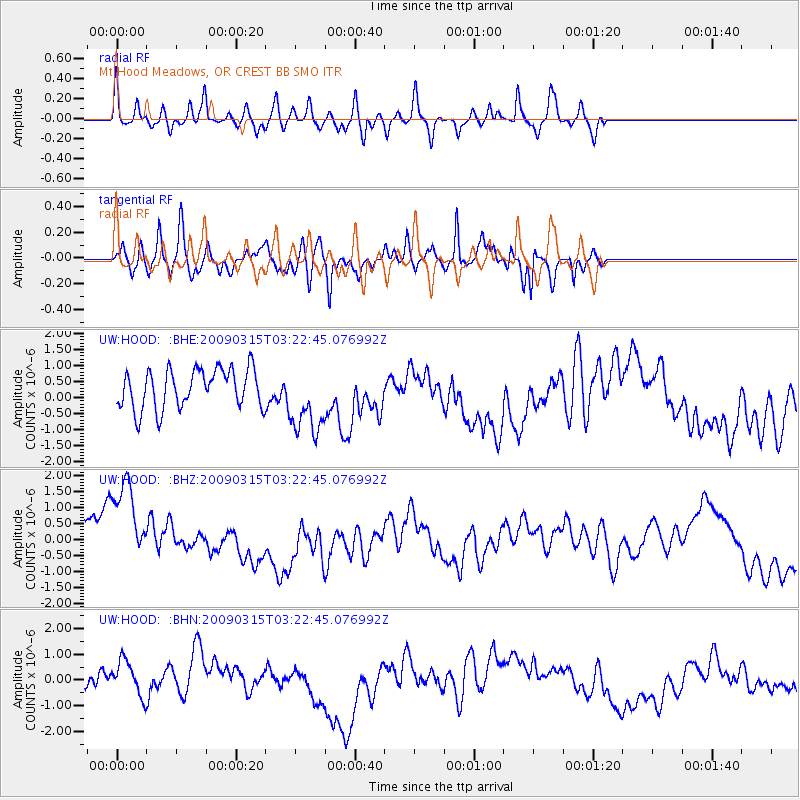
Signal To Noise
| Channel | StoN | STA | LTA |
| UW:HOOD: :BHZ:20090315T03:22:45.076992Z | 3.151995 | 1.6963643E-6 | 5.381875E-7 |
| UW:HOOD: :BHN:20090315T03:22:45.076992Z | 1.7706931 | 7.611622E-7 | 4.2986682E-7 |
| UW:HOOD: :BHE:20090315T03:22:45.076992Z | 1.8351436 | 1.1175488E-6 | 6.089707E-7 |
| Arrivals |
| Ps | |
| PpPs | |
| PsPs/PpSs | |


